Login

Passwort vergessen?

Cookies müssen akzeptiert werden!
Die Cookie-Funktion Ihres Browsers ist deaktiviert. Bitte aktivieren Sie die Funktion.

Noch kein Mitglied?

Jetzt Registrieren
Login

Nur für eingeloggte Benutzer möglich

Melde dich an, um diese Funktion nutzen zu können.

Passwort vergessen?

Cookies müssen akzeptiert werden!
Die Cookie-Funktion Ihres Browsers ist deaktiviert. Bitte aktivieren Sie die Funktion.

Noch kein Mitglied?

Jetzt Registrieren
Filter
Kategorien
Erweiterte Filter
  • Länge (km)
  • Höhenmeter
Filter speichern Filter zurücksetzen

TrackRank

QRCode

Technische Daten

Länge45,8 km Höhenmeter1586 m Abstieg1581 m Dauer00:00 h:m Datum08.09.2022
Bewertungen Autor Landschaft Spaßfaktor Kondition Technik

Statistik

189 Views Bewertungen 2 Downloads Durchschnitt
Bewerten
  • Tourenblatt
  • Anfahrt
  • Downloads

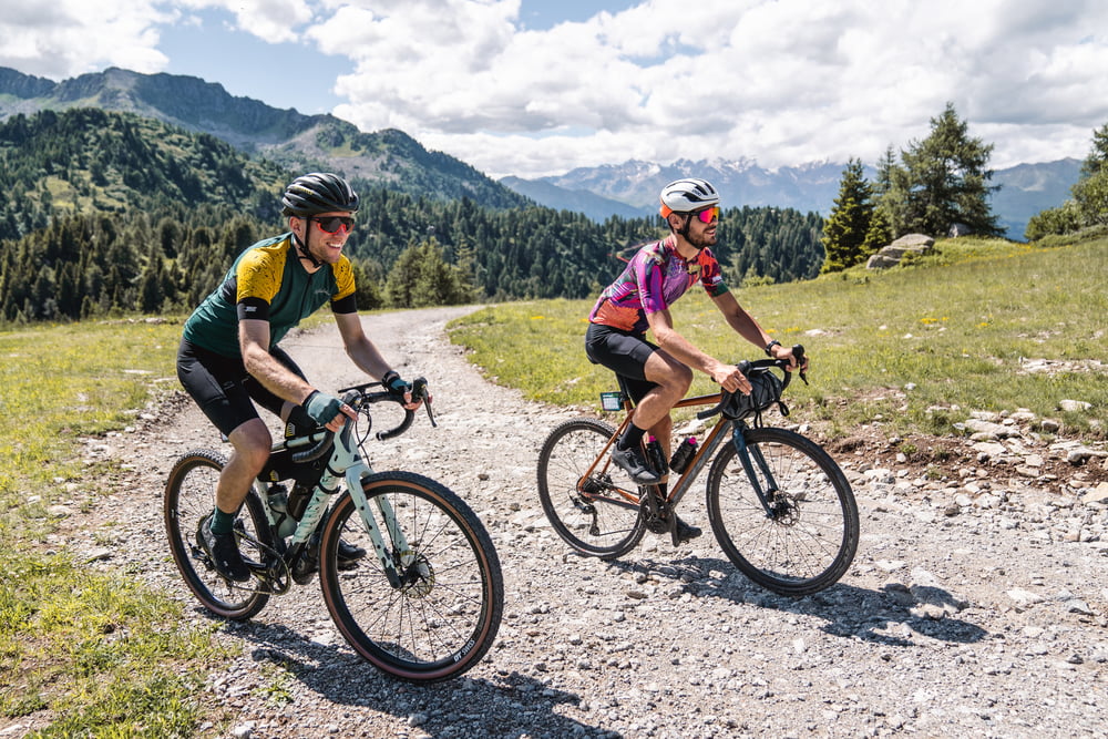
After having covered part of the "Bassa Valle" route, you take the direction of Val Meledrio. The forest begins immediately beautiful and steep but always rideable and never technical, thanks to the trees you will never suffer the heat (there is also a fountain halfway up). There are several breathtaking views of small waterfalls, streams and side valleys until you reach the large viewpoint of Madonna di Campiglio (with fountain). 

From the viewpoint onwards, the route continues uphill to the summit of Monte Vigo, where the Brenta Dolomites can be admired. There may be short stretches of portage if you lack the training for short but steep climbs. From there, you take a steep descent on a dirt road to Lago dei Caprioli. Returning to asphalt -that for the entire route you almost forget it exists- you reach Ossana and its fountain.

Weitere Informationen unter

https://www.komoot.it/tour/883333695

Tour Galerie

Tour Karte und Höhenprofil

  • Open Street Map
  • Google
Minimale Höhe 776 m Maximale Höhe 2130 m Detailansicht

Mehr zum Tourautor

Helios_Bolzano
Mitglied seit 2020

Land: Italien

5 erstellte Touren
8.4
Private Nachricht senden

Kommentare

For directions head over https://www.visitvaldisole.it/en/how-to-get-here

GPS-Tracks

Trackpunkte
  • GPX / Garmin Map Source (gpx) download
  • TCX / Garmin Training Center® (tcx) download
  • CRS / Garmin Training Center® (crs) download
  • Google Earth (kml) download
  • G7ToWin (g7t) download
  • TTQV (trk) download
  • Overlay (ovl) download
  • Fugawi (txt) download
  • Kompass (DAV) Track (tk) download
  • Tourenblatt (pdf) download
  • Originaldatei des Autors (gpx) download

Mehr zum Tourautor

Helios_Bolzano
Mitglied seit 2020

Land: Italien

5 erstellte Touren
8.4
Private Nachricht senden
Tour teilen
Zu meinen Favoriten hinzufügen
Von meinen Favoriten entfernen
Tags bearbeiten
Meine Bewertung
Bewerten
Tour: Alpine Gravel - Monte Vigo
Art: Fahrrad Touring
Länge: 45,8 km
Bewertet am:
Dauer:
Tag(e)
Stunde(n)
Minute(n)
Bewertung: Landschaft Spaßfaktor Kondition Technik