Přihlášení

Zapomenutý login?

Soubory cookie musí být akceptovány!
Funkce cookies ve vašem prohlížeči je deaktivována. Aktivujte prosím tuto funkci.

Ještě nejste členem?

Zaregistrujte se nyní
Přihlášení

Možné pouze pro přihlášené uživatele

Přihlaste se, abyste mohli tuto funkci používat.

Zapomenutý login?

Soubory cookie musí být akceptovány!
Funkce cookies ve vašem prohlížeči je deaktivována. Aktivujte prosím tuto funkci.

Ještě nejste členem?

Zaregistrujte se nyní
Filtr
Kategorie
Pokročilé filtry
  • Délka (km)
  • Výškoměr
Uložit filtr Obnovit filtr

TrackRank

QRCode

Technické údaje

Délka23,0 km Výškoměr0 m Sestup0 m Doba02:00 h:m Datum30.08.2012
Hodnocení Autor Krajina Faktor zábavy Náročnost Technika

Statistika

172 Přehledy Hodnocení 9 Downloady Průměr
Hodnotit
  • Formulář trasy
  • Příjezd
  • Downloady

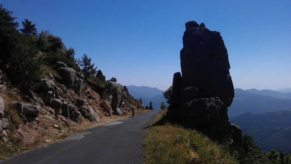
The first part of the uphill is quite steep and on sunny days you will be "kissed by the flame". The partially ruined "Église Saint-Martin de Corsavy" just before reaching the village of Corsavy is definitely worth a stop. In Corsavy refill your bottles at the fountain in the center, this will be your last chance to do so until you reach the Refuge de Batère. After Corsavy the road goes almost flat northward for some km's (nice to prepare for the final uphill).  After passing abandoned old mines and miner's homes you'll finally reach the "Refuge de Batère" (1450m) - enjoy a well earned rest up there (btw: the food is excellent).

If you want you can take a short hike on an unpaved road to the Tour the Batère (the old stone tower you've seen just before reaching the Refuge). The view from this old stone signaltower is stunning (look for other towers in sight, witch which the Tour the Batère was communicating in the past).

Trasa mapa a výškový profil

  • Open Street Map
  • Google
Minimální výška 99999 m Maximální výška -99999 m Detailní náhled

Více o autorovi turné

DonSegafredo
Členem od 2011

Odeslat soukromou zprávu

Komentáře

Start west of Arles sur Tech, where the D43 begins. If you came by car, you'll find some place to park there.

Trasy GPS

Trackpoints
  • GPX / Garmin Map Source (gpx) download
  • TCX / Garmin Training Center® (tcx) download
  • CRS / Garmin Training Center® (crs) download
  • Google Earth (kml) download
  • G7ToWin (g7t) download
  • TTQV (trk) download
  • Overlay (ovl) download
  • Fugawi (txt) download
  • Kompass (DAV) Track (tk) download
  • Formulář trasy (pdf) download
  • Původní soubor autora (gpx) download

Více o autorovi turné

DonSegafredo
Členem od 2011

Odeslat soukromou zprávu
Share track
Přidat do oblíbených
Odebrat z oblíbených položek
Upravit značky
Moje hodnocení
Hodnotit
Trasa: To the Refuge de Batère
Druh: Závodní kolo
Délka: 23,0 km
Hodnoceno na:
Doba:
Den(y)
Hodina(y)
Minuta(y)
Hodnocení: Krajina Faktor zábavy Náročnost Technika