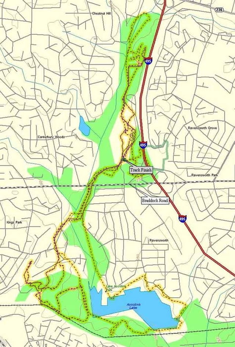
This is a great trail for some night-riding, since it's close to DC and just a short ride. Wakefield has a spider-web of interconnected trails throughout the park, north and west of the main facilities. In addition, just east of the facilities, go off the path at the bridge and through a 10' diameter water pipe to find a whole different network of trails. These have a little more steepness to them. To get to Lake Accotink, follow the gravel path south and under Braddock Road. Stay on the path for ~2 miles and hop off anywhere you see single-track. These trails wind up to the railroad tracks and around the Lake. These trails are much longer and faster than Wakefield, and they are also drier. Both sections combine for a nice 10 mile ride.
Další informace v části
http://www.raidoh.comTrasa mapa a výškový profil
Minimální výška -23 m
Maximální výška 111 m
Komentáře

Off the Capital Beltway, I-495, just West of where I-95 North enters, take Braddock Road West. At the first light take a right into the park.
Trasy GPS
Trackpoints-
GPX / Garmin Map Source (gpx) download
-
TCX / Garmin Training Center® (tcx) download
-
CRS / Garmin Training Center® (crs) download
-
Google Earth (kml) download
-
G7ToWin (g7t) download
-
TTQV (trk) download
-
Overlay (ovl) download
-
Fugawi (txt) download
-
Kompass (DAV) Track (tk) download
-
Formulář trasy (pdf) download
-
Původní soubor autora (g7t) download
Přidat do oblíbených
Odebrat z oblíbených položek
Upravit značky
Open track
Moje hodnocení
Hodnotit


