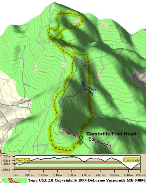
ROCKS, ROCKS AND MORE ROCKS. I love it, but there are a lot of rocks. This single track park has more trails than you can pass out after. Take a look at the map in the parking lot and plot a course. Watch out, because the blue trail is 100 hundred miles long if you decide to "see how far it goes". There is lots of elevation, so any which way you go will have some great downhill and technical uphill. There is a power-line trail with a really killer downhill, and a great downhill leading to the bottom of the mountain with virtually no rocks. The trails lead to some beautiful overlooks, so bring a camera if you can. This is an intermediate to advanced ride, so prepare accordingly. High tire pressure, spare tires, water, and bike tools are a must.
Další informace v části
http://www.raidoh.comTrasa mapa a výškový profil
Minimální výška 329 m
Maximální výška 538 m
Komentáře

Located just west of Frederick, MD. Take I-270 North into Frederick and take Patrick Street(Route 40)West through town. There's even a bike shop on the right or left as make your way through town. Right on Gambrills State Park Road and the parking lot is the first on the right. A map and trailheads are right there.
Trasy GPS
Trackpoints-
GPX / Garmin Map Source (gpx) download
-
TCX / Garmin Training Center® (tcx) download
-
CRS / Garmin Training Center® (crs) download
-
Google Earth (kml) download
-
G7ToWin (g7t) download
-
TTQV (trk) download
-
Overlay (ovl) download
-
Fugawi (txt) download
-
Kompass (DAV) Track (tk) download
-
Formulář trasy (pdf) download
-
Původní soubor autora (g7t) download
Přidat do oblíbených
Odebrat z oblíbených položek
Upravit značky
Open track
Moje hodnocení
Hodnotit


