


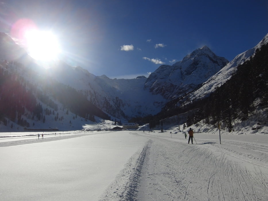
Ende Januar und immer noch kein Schnee - außer in Lüsens! Einzig im Sellrain-Tal war Winterlandschaft garantiert. Selbst in den Schneelöchern Leutasch und Pertisau gabs Loipe auf der grünen Wiese.
Aber hier gabs echt Winterwonderland. Die Auswahl an Loipen ist nicht so groß, aber für einen Tag ausreichend und die Kulisse ist fantastisch. Die Loipen waren frisch präpariert und damit alles super.
Wir hatten sogar Sonnenschein und damit einen fantastischen Langlauftag.
Další informace v části
http://www.sellraintal.at/winter-sommer-sellraintal/winterurlaub/langlaufen/liste-loipen.htmlGalerie tras


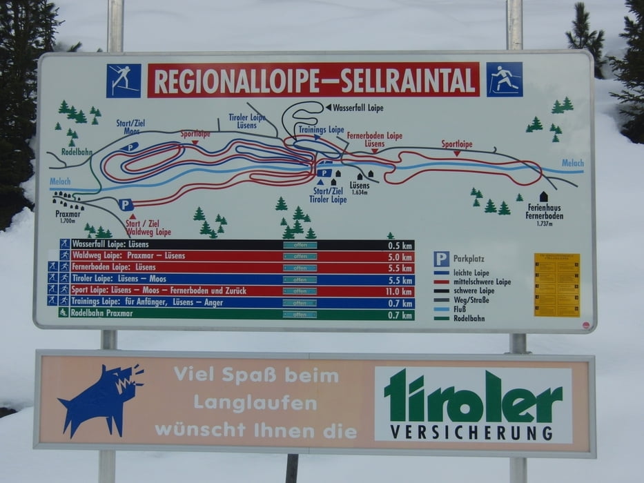
Trasa mapa a výškový profil
Minimální výška 1590 m
Maximální výška 1735 m
Více o autorovi turné

|
smartandem |
Komentáře

Über die A96 bis Garmisch, dann weiter über Mittenwald, Scharnitz und Zirler Berg hinunter ins Inntal. Dort gehts rüber ins Sellraintal und die ganzen Höhenmeter hoch nach Lüsens. Ab Gries ist die Straße relativ schmal und am Schluß mit mehreren Serpentienen. Mit dem Bus eine Herausforderung. Lüsens ist immerhin 1634 Meter hoch.
Parkplatz gibts am Gasthof - Gebührenpflichtig (weiß aber nicht wie teuer, da wir mit dem Bus dort waren).
Trasy GPS
Trackpoints-
GPX / Garmin Map Source (gpx) download
-
TCX / Garmin Training Center® (tcx) download
-
CRS / Garmin Training Center® (crs) download
-
Google Earth (kml) download
-
G7ToWin (g7t) download
-
TTQV (trk) download
-
Overlay (ovl) download
-
Fugawi (txt) download
-
Kompass (DAV) Track (tk) download
-
Formulář trasy (pdf) download
-
Původní soubor autora (gpx) download
Více o autorovi turné
|
|
smartandem |
Přidat do oblíbených
Odebrat z oblíbených položek
Upravit značky
Open track
Moje hodnocení
Hodnotit