
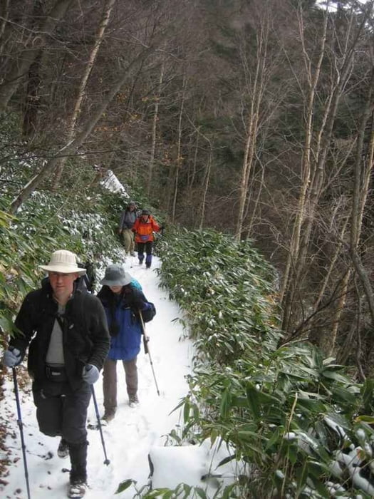

This is an easy loop hike starting at Yumoto Onsen in Oku-Nikko, and ending at Kotoku Onsen, from where you can get a bus back to Yumoto or Nikko.
You can hike this from May to December, and snowshoe it from late December to April.
It takes about 5 hours, and you should purchase a hiking map (the 'Yama-tokougen' series are best).
You can hike this from May to December, and snowshoe it from late December to April.
It takes about 5 hours, and you should purchase a hiking map (the 'Yama-tokougen' series are best).
Galerie tras

Trasa mapa a výškový profil
Minimální výška 1423 m
Maximální výška 1744 m
Více o autorovi turné

|
zangezur |
Komentáře

From Tobu-Asakusa in Tokyo take the Tobu line to Tobu-Nikko. The 7.10 train will get you to Nikko at 9.15. Then take a bus from opposite the station to Nikko-Yumoto (at 9.24), which will take 1.5 hours.
It's best to stay one night in Yumoto Onsen to be able to enjoy the area without rushing back to Tokyo.
From Yumoto Onsen find the trai which climbs up to the highway from behind the village (where you can see the hot springs), then cross the highway, and hike along the valley beyond. This trail will take you up to a pass, then down into another valley leading to two lakes, Karikomi-ko and Kirikomi-ko. Past there you will see a road up ahead, which you will need to cimb up to. Turn right on the road, then immediately take a trail off to the right, which will then descend into the valey beyond, leading down towards Kotoku Onsen, where you will find a hotel. (In winter they have XC skiing). There is a bus stop here with departures for both Yumoto Onsen and Nikko.
Trasy GPS
Trackpoints-
GPX / Garmin Map Source (gpx) download
-
TCX / Garmin Training Center® (tcx) download
-
CRS / Garmin Training Center® (crs) download
-
Google Earth (kml) download
-
G7ToWin (g7t) download
-
TTQV (trk) download
-
Overlay (ovl) download
-
Fugawi (txt) download
-
Kompass (DAV) Track (tk) download
-
Formulář trasy (pdf) download
-
Původní soubor autora (gpx) download
Více o autorovi turné
|
|
zangezur |
Přidat do oblíbených
Odebrat z oblíbených položek
Upravit značky
Open track
Moje hodnocení
Hodnotit