

st1\:*{behavior:url(#ieooui) }
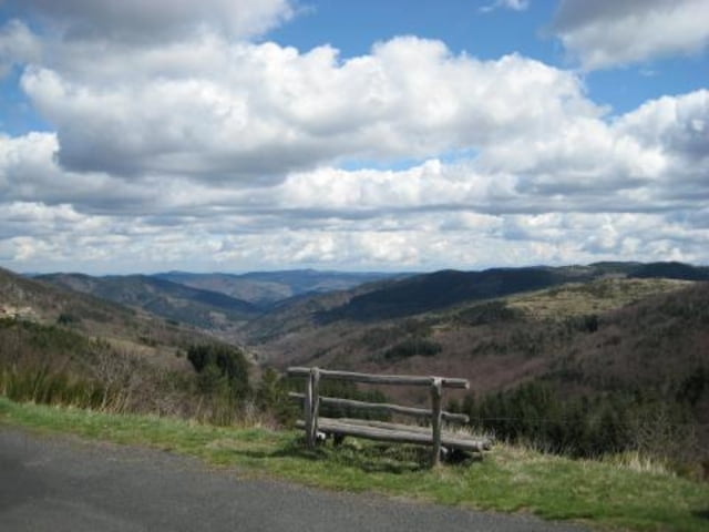
This route runs from the eastern part of the Ardeche all the way to the western border and back. It visits the highest mountains in the Ardeche, including the source of the river Loire (the longest river in France). The route also runs past a lake inside an old vulcanic crater (Lac d’Issarlès). In the town Lachamp-Raphaël you can make a small detour and visit la cascade du Ray-Pic (waterfall). And ofcourse the route is just one curve after another.
Because this route is non-stop curves on two lane as well as single lane roads, it is a quite demanding route and may be more suitable for more experienced riders.
---
Deze route loopt vanaf het oosten van de Ardeche (Het startpunt ligt +/-15km zuid-westelijk van Valence) naar het uiterste westen van de Ardeche. Hij voert naar de hoogste toppen van de Ardeche en daarbij ook naar de bron van de Loire (de langste rivier van Frankrijk). Ook loopt de route langs een meer in een oude vulkaankrater (Lac d’Issarlès). In het dorpje Lachamp-Raphaël kunt u eventueel van de route afwijken om la cascade du Ray-Pic (waterval) te bezoeken. Voor de rest is de route een bochtenfeest.
Deze route is meer geschikt voor meer ervaren rijders, omdat de route bijna non-stop bochten bevat over zowel tweebaans als enkelbaans wegen.
---
Op www.motorrijden.fr kunt u deze track ook als route downloaden.
Další informace v části
http://www.motorrijden.frGalerie tras


Trasa mapa a výškový profil
Minimální výška 99999 m
Maximální výška -99999 m
Více o autorovi turné

|
Rambling_man |
Komentáře

Trasy GPS
Trackpoints-
GPX / Garmin Map Source (gpx) download
-
TCX / Garmin Training Center® (tcx) download
-
CRS / Garmin Training Center® (crs) download
-
Google Earth (kml) download
-
G7ToWin (g7t) download
-
TTQV (trk) download
-
Overlay (ovl) download
-
Fugawi (txt) download
-
Kompass (DAV) Track (tk) download
-
Formulář trasy (pdf) download
-
Původní soubor autora (gpx) download
Více o autorovi turné
|
|
Rambling_man |
Přidat do oblíbených
Odebrat z oblíbených položek
Upravit značky
Open track
Moje hodnocení
Hodnotit