Přihlášení

Zapomenutý login?

Soubory cookie musí být akceptovány!
Funkce cookies ve vašem prohlížeči je deaktivována. Aktivujte prosím tuto funkci.

Ještě nejste členem?

Zaregistrujte se nyní
Přihlášení

Možné pouze pro přihlášené uživatele

Přihlaste se, abyste mohli tuto funkci používat.

Zapomenutý login?

Soubory cookie musí být akceptovány!
Funkce cookies ve vašem prohlížeči je deaktivována. Aktivujte prosím tuto funkci.

Ještě nejste členem?

Zaregistrujte se nyní
Filtr
Kategorie
Pokročilé filtry
  • Délka (km)
  • Výškoměr
Uložit filtr Obnovit filtr

TrackRank

QRCode

Technické údaje

Délka27,5 km Výškoměr408 m Sestup428 m Doba00:00 h:m Datum26.04.2009
Hodnocení Autor Krajina Faktor zábavy Náročnost Technika

Statistika

1464 Přehledy Hodnocení 147 Downloady Průměr
Hodnotit
  • Formulář trasy
  • Příjezd
  • Downloady

MTB on Omberg

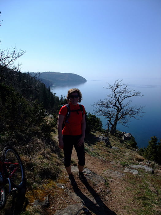
Omberg is beautifully situated by the shores of Lake Vättern. The flora is very varied and there are lots of flowers in spring time.

The forested hill Omberg is a popular area for outdoor avtivities and there are several hiking trails but not all of them suited for biking.Give way to walkers, be especially careful around the most popular areas around Hjässan, Ellen Key's Strand and Stocklycke.

The tour

This tour is best done clockwise and consists of a mixture of  trails (64%), gravel (17%) and tarmac (19%).

There are challanging climbs, fast and fun downhills, lovely views of Lake Vättern and the surrounding plains.

Today we started and ended the loop at Ellen Key's Strand. Other possible starting points are; Ombergs Turisthotell, Stocklycke, Storpissan or Hjässatorget.

Food breaks

If you don't BYO, tehe are lunch and snack possibilities en-route at Ombergs Turishotell and Stocklycke. Close to the trail are Borghamn and Hästholmen.

Places to stay

Try the web site "Tiderna landskap - A Spritual Haven" www.tidernaslandskap.se/Default.asp

Další informace v části

http://www.sveaskog.se/Jakt-fiske-och-friluftsliv/besoksomraden/ekoparker/Ekopark-Omberg/

Galerie tras

Trasa mapa a výškový profil

  • Open Street Map
  • Google
Minimální výška 80 m Maximální výška 246 m Detailní náhled

Více o autorovi turné

Eva
Členem od 2006

Odeslat soukromou zprávu

Komentáře

derwolf on 24.08.2015

Great tour!

We did this thour beginning of August this year and it was really great! We started at the north end and did it clockwise. First some forrest roads for warm-up, then trails, trails, trails in such a beautiful landscape. Definitely one of the best MTB tours I ever did in Sweden! Thanks a lot for tracking it.

Trasy GPS

Trackpoints
  • GPX / Garmin Map Source (gpx) download
  • TCX / Garmin Training Center® (tcx) download
  • CRS / Garmin Training Center® (crs) download
  • Google Earth (kml) download
  • G7ToWin (g7t) download
  • TTQV (trk) download
  • Overlay (ovl) download
  • Fugawi (txt) download
  • Kompass (DAV) Track (tk) download
  • Formulář trasy (pdf) download
  • Původní soubor autora (gpx) download

Více o autorovi turné

Eva
Členem od 2006

Odeslat soukromou zprávu
Share track
Přidat do oblíbených
Odebrat z oblíbených položek
Upravit značky
Moje hodnocení
Hodnotit
Trasa: MTB on Omberg
Druh: Horské kolo
Délka: 27,5 km
Hodnoceno na:
Doba:
Den(y)
Hodina(y)
Minuta(y)
Hodnocení: Krajina Faktor zábavy Náročnost Technika