

Start from Wittgensteinstrasse 23. Bezirk.
The nicest to ride the track is from Mauer -> Laab im Walde ->Breitenfurt -> Kaltenleutgeben.
I tried to do mostly trails and Wanderwege, but please do realize you (and me) are illegal bikers at some parts. (but isn't that a lot of fun??) I consider this not a Sunday-Familienstrecke but more for technically skilled bikers that like single trails.
Tour: After the long downhill from Mauer you reach the Gutenbachstrasse and cross it to go uphill. On top there are 3 possibilities.
1)Follow the Stadwanderweg 6 (turn left), downhill in the direction of Bundesstrasse 13, or
2) make an additional round and go straight up,- like I did - and enjoy a nice downhill Wanderweg, cross the 2 wooden bridges und turn right and come back at alsmost the same place as where you turned left.
3) At the crossing of Stadwanderweg go straight like under 2) and do not turn left.You miss the downhill and the extra Hohenmeter.
Please check the track to better understand.
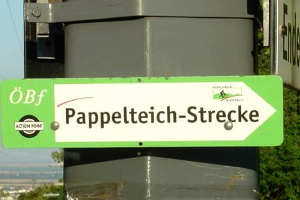
After you did the steep downhill in the woods near Laab you reach the area where the horse stables are. At that point you can cross a part of "Privat grund" where you will be chased by dogs and owner (without shotgun) and you get a steep and muddy horsetrack uphill back to the original Pappelteichstrecke. (See my other GPS track on this site called "Rundum Pappelteich", to find it). On this tour i did not do it and went directly to the Bundesstrasse 13 and entered there the Kaltenleutgebenstrecke pass the "Barmherzigen Schwestern"
When coming out of the woods, you will hit the Breitenfurterhaupstrasse. This is the connection to the Kaltenleutgebenstrecke and you will have to follow the Schotterautobahn for some time. Than the fun starts... A steep uphill (nicht schieben) to reach the Waldsportplatz and turn left to enter the "surfing trail". Try to do this as fast as you can can. It is like riding the waves. At the end of the trail there is a memorial statue and a bench, just behind the bence there is a narrow but nice trail that is really hidden. This is the only place where you may have to get of the bike because of a big tree. You pass the "quelle" and are at the bottom of Doktorsberg. Follow the trail left from the uphill road and coming on top you are on the Pappelteich again.
Downhill full-speed on the ski slope near Wienerhutte and than some Wanderwege back to the Liesingbach /Kalksburg (thanks to biker "texx" for the last part...) and up the asphalt road towards 23. Bezirk. Turn left after the bridge on the asphalt road and do some more trails in the Mauer forest and you are back at the starting point.
Funstrecke!!
Trasa mapa a výškový profil
Minimální výška 244 m
Maximální výška 447 m
Více o autorovi turné

|
zwartr |
Komentáře

Wittgensteinstrasse 23. Bezirk wien
Trasy GPS
Trackpoints-
GPX / Garmin Map Source (gpx) download
-
TCX / Garmin Training Center® (tcx) download
-
CRS / Garmin Training Center® (crs) download
-
Google Earth (kml) download
-
G7ToWin (g7t) download
-
TTQV (trk) download
-
Overlay (ovl) download
-
Fugawi (txt) download
-
Kompass (DAV) Track (tk) download
-
Formulář trasy (pdf) download
-
Původní soubor autora (gpx) download
Více o autorovi turné
|
|
zwartr |
Přidat do oblíbených
Odebrat z oblíbených položek
Upravit značky
Open track
Moje hodnocení
Hodnotit