
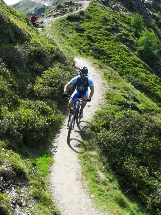

Tour starts with long uphill on unpaved road. You can park your car on parking at the bottom of cable car station. On the top there is nice cottage with good strudel and other cakes. Downhill is on the average not very difficult for bikers of all mountain category, but there are some short parts with S2 singletrail skala difficulty. About 1/3 of downhill is on the unpaved road, other part is trail. Somewhere in the middle of downhill you will probably think that track is wrong (small cottage on the left). Just proceed and follow the track. After short walk through bushes trail will continue. The bottom part of downhill is steep trail in the forest.Please take care not to leave traces of braking on the trail.
Další informace v části
http://84.255.207.31/gallery/v/uporabniki/pokora/goldeck2/Galerie tras


Trasa mapa a výškový profil
Minimální výška 561 m
Maximální výška 2070 m
Více o autorovi turné
|
|
cindro |
Komentáře

Tour starts in Spittal at cable car station.
Trasy GPS
Trackpoints-
GPX / Garmin Map Source (gpx) download
-
TCX / Garmin Training Center® (tcx) download
-
CRS / Garmin Training Center® (crs) download
-
Google Earth (kml) download
-
G7ToWin (g7t) download
-
TTQV (trk) download
-
Overlay (ovl) download
-
Fugawi (txt) download
-
Kompass (DAV) Track (tk) download
-
Formulář trasy (pdf) download
-
Původní soubor autora (gpx) download
Více o autorovi turné
|
|
cindro |
Přidat do oblíbených
Odebrat z oblíbených položek
Upravit značky
Open track
Moje hodnocení
Hodnotit