Přihlášení

Zapomenutý login?

Soubory cookie musí být akceptovány!
Funkce cookies ve vašem prohlížeči je deaktivována. Aktivujte prosím tuto funkci.

Ještě nejste členem?

Zaregistrujte se nyní
Přihlášení

Možné pouze pro přihlášené uživatele

Přihlaste se, abyste mohli tuto funkci používat.

Zapomenutý login?

Soubory cookie musí být akceptovány!
Funkce cookies ve vašem prohlížeči je deaktivována. Aktivujte prosím tuto funkci.

Ještě nejste členem?

Zaregistrujte se nyní
Filtr
Kategorie
Pokročilé filtry
  • Délka (km)
  • Výškoměr
Uložit filtr Obnovit filtr

TrackRank

QRCode

Technické údaje

Délka34,4 km Výškoměr1094 m Sestup1092 m Doba02:30 h:m Datum28.07.2010
Hodnocení Autor User Krajina Faktor zábavy Náročnost Technika

Statistika

840 Přehledy 1 Hodnocení 135 Downloady 5.00 Průměr
Hodnotit
  • Formulář trasy
  • Příjezd
  • Downloady

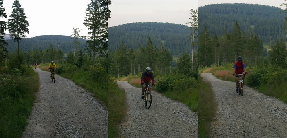
Von Lam aus über Berghäusl und die Bayerwaldloipe zum LL-Zentrum Scheiben. Weiter über Brennes-Sattel hinauf zum Arberschutzhaus. Rückweg über kleinen Arbersee wieder nach Lam.

Další informace v části

http://de.wikipedia.org/wiki/Gro%C3%9Fer_Arber

Galerie tras

Trasa mapa a výškový profil

  • Open Street Map
  • Google
Minimální výška 522 m Maximální výška 1366 m Detailní náhled

Více o autorovi turné

grenz-pfad-fahrer
Členem od 2009

Odeslat soukromou zprávu

Komentáře

Dodinho on 10.06.2014

zu empfehlen

sehr coole Tour. über Forstwege 1000 hm bergauf und über trails, forstwege und straße bergab. kurz nach beginn der abfahrt sind wir den steilen aber fahrbaren wanderpfad über die skipiste zur lamer bergwachthütte. etwas spannender zu fahren als über die steilen forststraßen wieder bergab. danach wie angegeben zum kleinen arbersee (bester trailabschnitt). nach dem kleinen arbersee sind wir nicht die teerstraße, sondern links paralell dazu das ausgetrocknete bachbett bis zur forststraße und dann rechts wieder auf die straße. ab da könnte man bergab wohl noch den ein oder anderen trail einbauen, da hab ich aber auch keinen mehr gekannt. alles in allem sehr tolle runde!

Start und Ziel ist das Schul- und Sportzentrum Lam mit ausreichend Parkmöglichkeiten.

Trasy GPS

Trackpoints
  • GPX / Garmin Map Source (gpx) download
  • TCX / Garmin Training Center® (tcx) download
  • CRS / Garmin Training Center® (crs) download
  • Google Earth (kml) download
  • G7ToWin (g7t) download
  • TTQV (trk) download
  • Overlay (ovl) download
  • Fugawi (txt) download
  • Kompass (DAV) Track (tk) download
  • Formulář trasy (pdf) download
  • Původní soubor autora (gpx) download

Více o autorovi turné

grenz-pfad-fahrer
Členem od 2009

Odeslat soukromou zprávu
Share track
Přidat do oblíbených
Odebrat z oblíbených položek
Upravit značky
Moje hodnocení
Hodnotit
Trasa: Lam - Arberschutzhaus
Druh: Horské kolo
Délka: 34,4 km
Hodnoceno na:
Doba:
Den(y)
Hodina(y)
Minuta(y)
Hodnocení: Krajina Faktor zábavy Náročnost Technika