
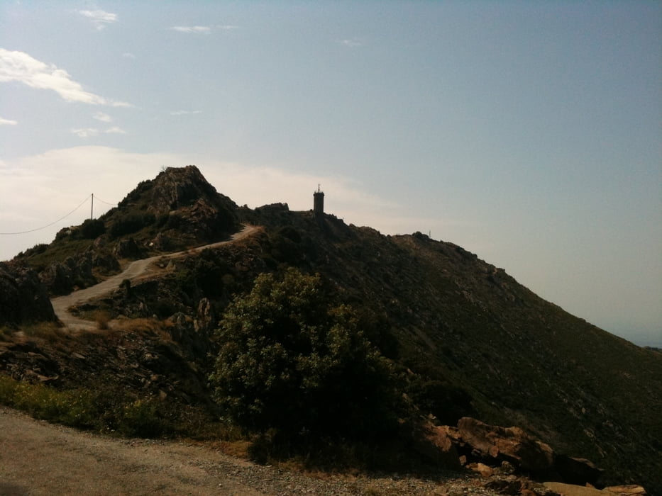

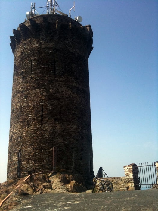
This tour takes you up to the Tour de Madeloc, where from you have a stunning view towards both the mountains and the coast. As soon as you left behind the crowded main road from Argeles you climb up a quiet paved road (D86), which in the first part is shady in the second part is unbelievably hot, when the sun is shining. Bring enough water, as there is no fountain or shop! You'll end up at the last uphil towards the tower, which is forbidden for cars, motorbikes,... The climb is incredibly steep and I confess: it was just my ego which prevented me from walking the rest instead of doing it on the bike. But the view from the top compensates for every drop of sweat you lost.
I went the same way back to Argeles, but you could also follow the D86 down to Banyuls sur mer. I saw also an unpaved road/singletrail starting at the summit, but I didn't do it. If anyone does, please post your experiences here!
Galerie tras


Trasa mapa a výškový profil
Minimální výška 99999 m
Maximální výška -99999 m
Více o autorovi turné

|
DonSegafredo |
Komentáře

Start at the southern beach of Argeles; there is a parking lot too (2.60 Euro/day at the time of writing)
Trasy GPS
Trackpoints-
GPX / Garmin Map Source (gpx) download
-
TCX / Garmin Training Center® (tcx) download
-
CRS / Garmin Training Center® (crs) download
-
Google Earth (kml) download
-
G7ToWin (g7t) download
-
TTQV (trk) download
-
Overlay (ovl) download
-
Fugawi (txt) download
-
Kompass (DAV) Track (tk) download
-
Formulář trasy (pdf) download
-
Původní soubor autora (gpx) download
Více o autorovi turné
|
|
DonSegafredo |
Přidat do oblíbených
Odebrat z oblíbených položek
Upravit značky
Open track
Moje hodnocení
Hodnotit