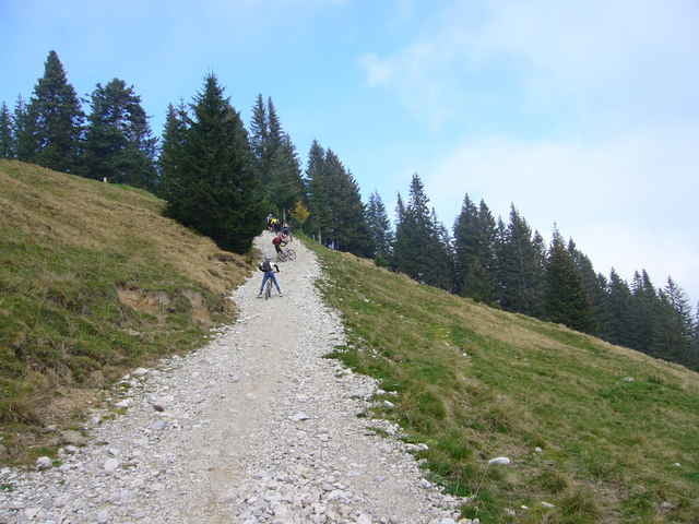
Die Kißlegger Mountainbiker waren im Herbst 07 im Ostallgäu unterwegs. Start war immer ein Parkplatz direkt an der A7 Ausfahrt Nesselwang. Die Gegend um Pfronten hat sehr viel zu bieten und ist landschaftlich vom feinsten.
Diesmal gings am Grüntensee vorbei hoch zur Schnitzlertalalpe und recht ruppig runter nach Jungholz. Dann auf Forstwegen wieder hoch zur Kappeler Alpe mit schöner Aussicht und Einkehrmöglichkeit. Nach rasanter Abfahrt nach Kappel wieder zurück zum Parkplatz. Die Tour ist ziemlich Anstrengend aber schön.
Diesmal gings am Grüntensee vorbei hoch zur Schnitzlertalalpe und recht ruppig runter nach Jungholz. Dann auf Forstwegen wieder hoch zur Kappeler Alpe mit schöner Aussicht und Einkehrmöglichkeit. Nach rasanter Abfahrt nach Kappel wieder zurück zum Parkplatz. Die Tour ist ziemlich Anstrengend aber schön.
Further information at
http://www.sgk-skiundrad.deTour map and elevation profile
Minimum height 840 m
Maximum height 1520 m
Comments
GPS tracks
Trackpoints-
GPX / Garmin Map Source (gpx) download
-
TCX / Garmin Training Center® (tcx) download
-
CRS / Garmin Training Center® (crs) download
-
Google Earth (kml) download
-
G7ToWin (g7t) download
-
TTQV (trk) download
-
Overlay (ovl) download
-
Fugawi (txt) download
-
Kompass (DAV) Track (tk) download
-
Track data sheet (pdf) download
-
Original file of the author (gpx) download
Add to my favorites
Remove from my favorites
Edit tags
Open track
My score
Rate


Den Stich hoch zur Fichtelhütte schafft wohl kaum jemand ?!
Kappeler Alpe