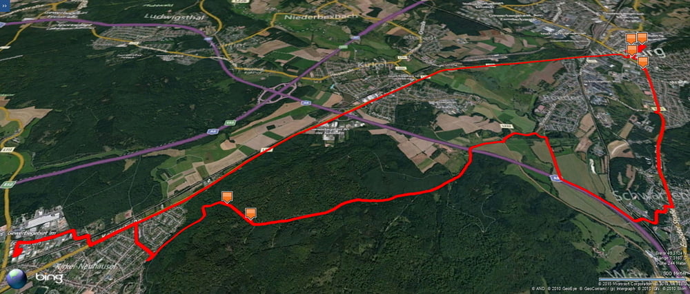
Ich fuhr einmal mehr bei Nacht von Homburg-Schwarzenbach über den Taubenpass nach Kirkel-Neuhäusel. Unglücklicherweise knickte ich meine Kette und konnte im Schein der Stirnlampe die Sache reparieren.
Am Abend hatte ich in Homburg noch ein paar Besorgungen zu machen und nahm deshalb den schnellen Weg entlang der Kaiserstraße um dann schnell in Homburg das Nötige zu erledigen.
Zum Abschluss durfte ich dann vollgeladen noch nach Schwarzenbach hochradeln.
Further information at
http://www.homburg.de/content/pages/home.htmTour gallery
Tour map and elevation profile
Minimum height 226 m
Maximum height 335 m
Comments

Start und Ziel in Homburg-Schwarzenbach.
GPS tracks
Trackpoints-
GPX / Garmin Map Source (gpx) download
-
TCX / Garmin Training Center® (tcx) download
-
CRS / Garmin Training Center® (crs) download
-
Google Earth (kml) download
-
G7ToWin (g7t) download
-
TTQV (trk) download
-
Overlay (ovl) download
-
Fugawi (txt) download
-
Kompass (DAV) Track (tk) download
-
Track data sheet (pdf) download
-
Original file of the author (gpx) download
Add to my favorites
Remove from my favorites
Edit tags
Open track
My score
Rate

