Login

Forgotten password?

Cookies have to be accepted!
Your browser's cookie functionality is disabled. Please enable this functionality.

Not a member yet?

Register now
Login

Available for registred users only

Log in to use this feature.

Forgotten password?

Cookies have to be accepted!
Your browser's cookie functionality is disabled. Please enable this functionality.

Not a member yet?

Register now
Filter
Categories
Advanced filters
  • Distance (km)
  • Height
Save filters Reset filter

TrackRank

QRCode

Technical data

Distance35,5 km Height674 m Way down715 m Duration02:00 h:m Date07.04.2012
Scores Author User Landscape Fun factor Fitness Technique

Statistics

2437 Views 1 Score 357 Downloads 3.00 Average
Rate
  • Track data sheet
  • Directions
  • Downloads
 mtb tour mit schönen trails und treppenpasagen. am keltenwall entlang nach schloss prunn , randeck, schülerloch

Tour gallery

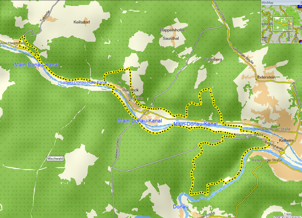
Tour map and elevation profile

  • Open Street Map
  • Google
Minimum height 344 m Maximum height 521 m Detailed view

More about the tour author

landendinger
Member since 2011

Send private message

Comments

longliveenduro on 11.04.2020

Okay

Nette Tour, die man mit einigen Trails auf dem Weg noch aufpeppen sollte/könnte
am besten startet und parkt man bei der donau staustufe

GPS tracks

Trackpoints
  • GPX / Garmin Map Source (gpx) download
  • TCX / Garmin Training Center® (tcx) download
  • CRS / Garmin Training Center® (crs) download
  • Google Earth (kml) download
  • G7ToWin (g7t) download
  • TTQV (trk) download
  • Overlay (ovl) download
  • Fugawi (txt) download
  • Kompass (DAV) Track (tk) download
  • Track data sheet (pdf) download
  • Original file of the author (gpx) download

More about the tour author

landendinger
Member since 2011

Send private message
Share track
Add to my favorites
Remove from my favorites
Edit tags
My score
Rate
Track: kelheim runde
Type: Mountain bike
Distance: 35,5 km
Evaluated on:
Duration:
Day(s)
Hour(s)
Minute(s)
Score: Landscape Fun factor Fitness Technique