


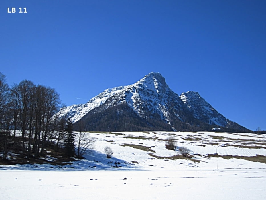
Der Winterwanderweg in der Nähe des Lindner Hotel & Spa - Die Wasnerin ist rund 5 Kilometer lang. In etwa 1,5 bis 2 Stunden wandert man im gemütlichen Tempo über die verschneiten Wiesen und geniesst auf jeden Meter die herrliche Aussicht mit Dachstein, Sartstein, Loser, Ausseerland und Totes Gebirge.
Mehr Infos und Fotos findest du auf biketours4you.at
The winter hiking trail in Bad Aussee near the Lindner Hotel & Spa - The Wasnerin is about 5 kilometers long. In about 1.5 to 2 hours you walk in a leisurely pace over the snow fields and enjoy every inch of it the beautiful views with the loveley austrian mountains: Dachstein, Sartstein, Loser the region Ausseerland and the alps Totes Gebirge ( Dead Mountains ).
more infos and photos on biketours4you.at
Further information at
http://www.biketours4you.at/oesterreich_langlauf_loipen_oest52a6caaa3de62326db35cbd7530eec8a/bad_aussee_skaten_langlauf_loipe67e9452f90c21d7c44655ef8177f8f00/bad_aussee_winter_winterwanderwe7a34ae9bab5f61d1034a86efe124e4a5.phpGalerie du tour
Carte du tour et altitude
Minimum height 720 m
Maximum height 760 m
More about the tour author
|
|
Trek1400d |
Commentaires

Tracks GPS
Trackpoints-
GPX / Garmin Map Source (gpx) download
-
TCX / Garmin Training Center® (tcx) download
-
CRS / Garmin Training Center® (crs) download
-
Google Earth (kml) download
-
G7ToWin (g7t) download
-
TTQV (trk) download
-
Overlay (ovl) download
-
Fugawi (txt) download
-
Kompass (DAV) Track (tk) download
-
Feuille de tours (pdf) download
-
Original file of the author (gpx) download
More about the tour author
|
|
Trek1400d |
Add to my favorites
Remove from my favorites
Edit tags
Open track
My score
Rate