


- Rundkurs im Uhrzeigersinn.
- Start: Riccione/Bike Hotel Gemma. Ziel: Riccione: Pasticceria Bianchi!!!!!
- Auf dem Radweg nach Gabicce Mare(ca.12 KM).
- Auf Asfalt nach Gabicce Monte KM 14,4 - MH 116.
- Weiter auf Asfalt zum geschichtsträchtigen Borgo Fiorenzuola KM 23,1 - MH 159.
- Wir befinden uns im verkehrsberuhigten Naturpark San Bartolo.
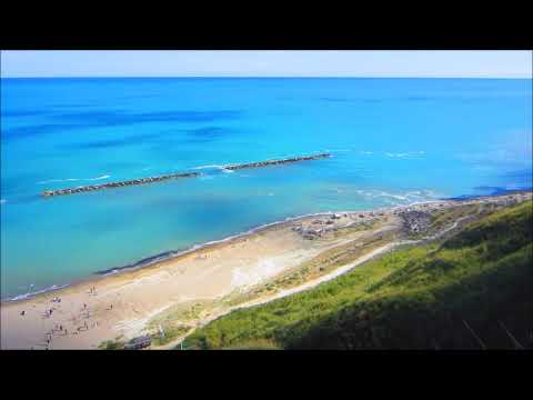
- Von Fiorenzuola führt ein steiler Asfaltweg hinunter zum wildromantischen Strand ca. 1,5 KM.
- Weiter durch die abwechslungsreiche Hügellandschaft bis zum befestigten Städtchen Gradara KM 47,1 - MH
- Wegbeschaffenheit der Tour: 95% Asfalt, davon 90% kaum befahrene Nebenstrassen/Wege.
- Kurze Abschnitte auf Schotterweg/Feldweg.
- Die meist kurzen, aber steilen Steigungen setzen eine gute Kondition voraus.(Bin mit dem E-MTB gefahren).
- Technische Grundkentniesse reichen aus.
- Empfohlene Jahreszeit: Frühjahr/Herbst.
- Bike Hotel Gemma - super Angebote für Biker bis 3. Oktober.
Galeria trasy


Mapa trasy i profil wysokości
Minimum height -13 m
Maximum height 268 m
More about the tour author
|
|
MargesinFriedrich |
Komentarze

GPS tracks
Trackpoints-
GPX / Garmin Map Source (gpx) download
-
TCX / Garmin Training Center® (tcx) download
-
CRS / Garmin Training Center® (crs) download
-
Google Earth (kml) download
-
G7ToWin (g7t) download
-
TTQV (trk) download
-
Overlay (ovl) download
-
Fugawi (txt) download
-
Kompass (DAV) Track (tk) download
-
Karta trasy (pdf) download
-
Original file of the author (gpx) download
More about the tour author
|
|
MargesinFriedrich |
Add to my favorites
Remove from my favorites
Edit tags
Open track
My score
Rate