


Start in Bornheim nach Euskirchen, um dort auf den Erftradweg Richtung Blankenheim abbiegen.
In Bad Münstereifel von einem freundlichen Polizisten darauf aufmerksam gemacht worden das man besser in Fußgängerzonen sein Fahrrad schiebt und die Musik aus dem Ohr läßt.
von da weitergefahren. Eine kleine Pause an der Erftquelle eingelegt.
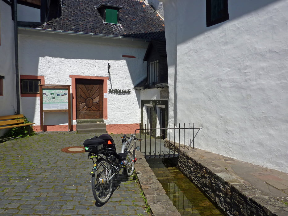
In Blankenheim nach einer Besichtigung der Ahrquelle weiter auf dem Ahrradweg weiter nach Remagen.
Von dort am Rhein entlang nach Bornheim zurück
Galeria trasy


Mapa trasy i profil wysokości
Minimum height 50 m
Maximum height 569 m
More about the tour author
|
|
Liegeradfahrer |
Komentarze

man kann auch in Bonn starten oder in Euskirchen. Dort fahren Züge hin die Fahrräder mitnehmen.
GPS tracks
Trackpoints-
GPX / Garmin Map Source (gpx) download
-
TCX / Garmin Training Center® (tcx) download
-
CRS / Garmin Training Center® (crs) download
-
Google Earth (kml) download
-
G7ToWin (g7t) download
-
TTQV (trk) download
-
Overlay (ovl) download
-
Fugawi (txt) download
-
Kompass (DAV) Track (tk) download
-
Karta trasy (pdf) download
-
Original file of the author (gpx) download
More about the tour author
|
|
Liegeradfahrer |
Add to my favorites
Remove from my favorites
Edit tags
Open track
My score
Rate