Login

Zabudli ste prihlasovacia meno

Cookies have to be accepted!
Your browser's cookie functionality is disabled. Please enable this functionality.

Not a member yet?

Register now
Login

Available for registred users only

Log in to use this feature.

Zabudli ste prihlasovacia meno

Cookies have to be accepted!
Your browser's cookie functionality is disabled. Please enable this functionality.

Not a member yet?

Register now
Filter
Kategórie
Advanced filters
  • Dĺžka (km)
  • výškomer
Uložiť filter Reset filter

TrackRank

QRCode

Technical data

Dĺžka16,2 km výškomer683 m Way down649 m Doba02:00 h:m dátum07.08.2015
ohodnotenia Author Kraj pôžitok z túry kondícia technika

štatistika

692 náhľady ohodnotenia 18 Stiahnutia priemer
Rate
  • list trasy
  • príjazd
  • Stiahnutia

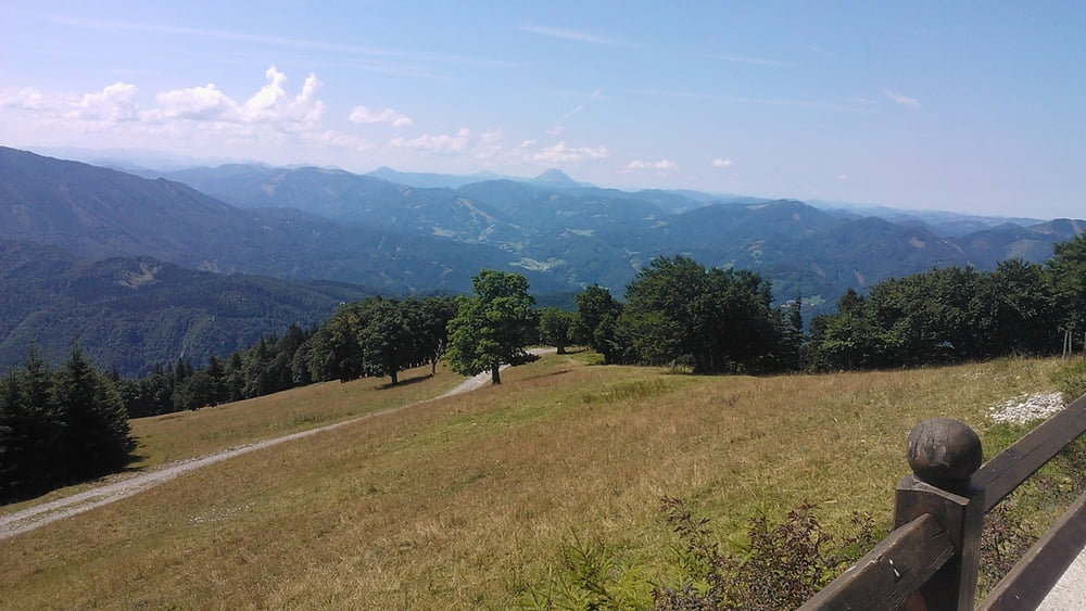
landschaftlich reizvolle Tour auf den Muckenkogel, Beginn entweder ab Berggasthof Billensteiner oder mit zusätzlichem Anstieg (230hm,2,7km) ab Talstation Muckenkogellift. Einkehrmöglichkeiten Berg Hinteralm/Traisnerhütte, Klosteralm, Lilienfelderhütte.


Mapa trasy a výškový profil

  • Open Street Map
  • Google
Minimum height 649 m Maximum height 1308 m Detailný pohľad

More about the tour author

chiefsky
Member since 2012

Send private message

komentáre

A1 St.PöltenSüd Abfahrt, Richtung Traisen und Lilienfeld.


GPS trasy

Trackpoints
  • GPX / Garmin Map Source (gpx) download
  • TCX / Garmin Training Center® (tcx) download
  • CRS / Garmin Training Center® (crs) download
  • Google Earth (kml) download
  • G7ToWin (g7t) download
  • TTQV (trk) download
  • Overlay (ovl) download
  • Fugawi (txt) download
  • Kompass (DAV) Track (tk) download
  • list trasy (pdf) download
  • Original file of the author (gpx) download

More about the tour author

chiefsky
Member since 2012

Send private message
Share track
Add to my favorites
Remove from my favorites
Edit tags
My score
Rate
trasa: Muckenkogel
Druh: horský bicykel
Dĺžka: 16,2 km
Evaluated on:
Doba:
Day(s)
Hour(s)
Minute(s)
ohodnotenie: Kraj pôžitok z túry kondícia technika