


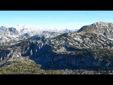
Nachdem wir am Vortag von Gößl am Grundlsee über die Lahngangseen bis zum Elm gewandert sind, haben wir eine sehr gesellige Nacht auf der Pühringerhütte verbracht. Die Pühringer Hütte befindet sich auf einer Höhe von 1.637m im Toten Gebirge nordöstlich vom Grundlsee. Die besonders schöne Lage am Elmsee auf der einen und den Kalkbergen auf der anderen Seite hat uns sehr beeindruckt. Das Gebiet mit den nahegelegenen Bergen Elm 2.128m und Rotgschirr 2.261m gehört auch zum Steirischen Salzkammergut. Hier beschreibe ich euch den Abstieg nach Grundlsee mit der Runde um den Salzofen 2.070m und über die Gößler Alm.
Weitere Infos und Fotos findest du auf biketours4you.at
galéria trás


Mapa trasy a výškový profil
Minimum height 713 m
Maximum height 2025 m
More about the tour author
|
|
Trek1400d |
komentáre

GPS trasy
Trackpoints-
GPX / Garmin Map Source (gpx) download
-
TCX / Garmin Training Center® (tcx) download
-
CRS / Garmin Training Center® (crs) download
-
Google Earth (kml) download
-
G7ToWin (g7t) download
-
TTQV (trk) download
-
Overlay (ovl) download
-
Fugawi (txt) download
-
Kompass (DAV) Track (tk) download
-
list trasy (pdf) download
-
Original file of the author (gpx) download
More about the tour author
|
|
Trek1400d |
Add to my favorites
Remove from my favorites
Edit tags
Open track
My score
Rate