Login

Si pozabil/a podatke za prijavo?

Cookies have to be accepted!
Your browser's cookie functionality is disabled. Please enable this functionality.

Not a member yet?

Register now
Login

Available for registred users only

Log in to use this feature.

Si pozabil/a podatke za prijavo?

Cookies have to be accepted!
Your browser's cookie functionality is disabled. Please enable this functionality.

Not a member yet?

Register now
Filter
Kategorije
Advanced filters
  • Dolžina (km)
  • Metri nadmorske višine
Shrani filter Reset filter

TrackRank

QRCode

Technical data

Dolžina19,9 km Metri nadmorske višine205 m Way down206 m Trajanje01:00 h:m Datum13.05.2014
Ocene Author Pokrajina Dejavnik zabave Kondicija Tehnika

Statistika

129 Pogledi Ocene 5 Prenosi Povprečje
Rate
  • List z izleti
  • Prihod
  • Prenosi

Nach einem heftigen Gewitter mit Hagel fuhr ich diese Variante von meiner Arbeitsstätte über die Passhöhe und des Taubentales zurück nach Schwarzenbach.

Ich dachte schon dass ich mich total einsauen würde. Dachte ich. Das Gewitter war lokal sehr begrenzt so dass der Wald fast keinen Tropfen abbekommen hat.

 .


Further information at

https://de.wikipedia.org/wiki/Homburg

Galerija izletov

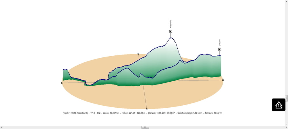
Zemljevid in višinski profil izleta

  • Open Street Map
  • Google
Minimum height 222 m Maximum height 324 m Prikaz podrobnosti

More about the tour author

Pheinz
Member since 2009

Send private message

Komentarji

In Schwarzenbach geht es los.

Poti GPS

Trackpoints
  • GPX / Garmin Map Source (gpx) download
  • TCX / Garmin Training Center® (tcx) download
  • CRS / Garmin Training Center® (crs) download
  • Google Earth (kml) download
  • G7ToWin (g7t) download
  • TTQV (trk) download
  • Overlay (ovl) download
  • Fugawi (txt) download
  • Kompass (DAV) Track (tk) download
  • List z izleti (pdf) download
  • Original file of the author (gpx) download

More about the tour author

Pheinz
Member since 2009

Send private message
Share track
Add to my favorites
Remove from my favorites
Edit tags
My score
Rate
Izlet: 140513-Tagestour
Vrsta: Izleti s kolesom
Dolžina: 19,9 km
Evaluated on:
Trajanje:
Day(s)
Hour(s)
Minute(s)
Ocena: Pokrajina Dejavnik zabave Kondicija Tehnika