


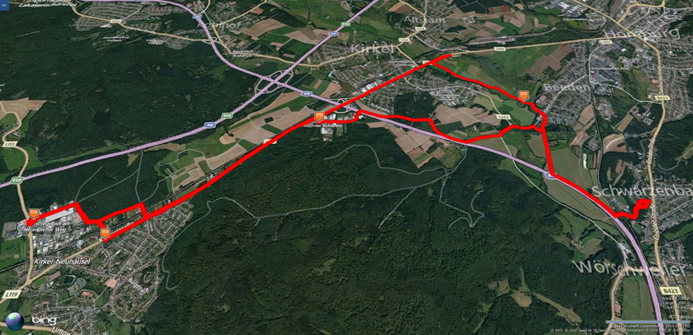
Kurze und flache Runde zwischen Schwarzenbach und Kirkel-Neuhäusel.
Auf bekanntem Weg von Schwarzenbach nach Kirkel-Neuhäusel und am Abend zuerst zum Bäcker meines Vertrauens. Weiter zu Aldi. Dort habe ich die gerade angebotenen Herbstradhosen gecheckt und verworfen.
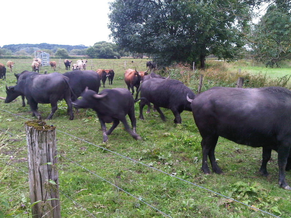
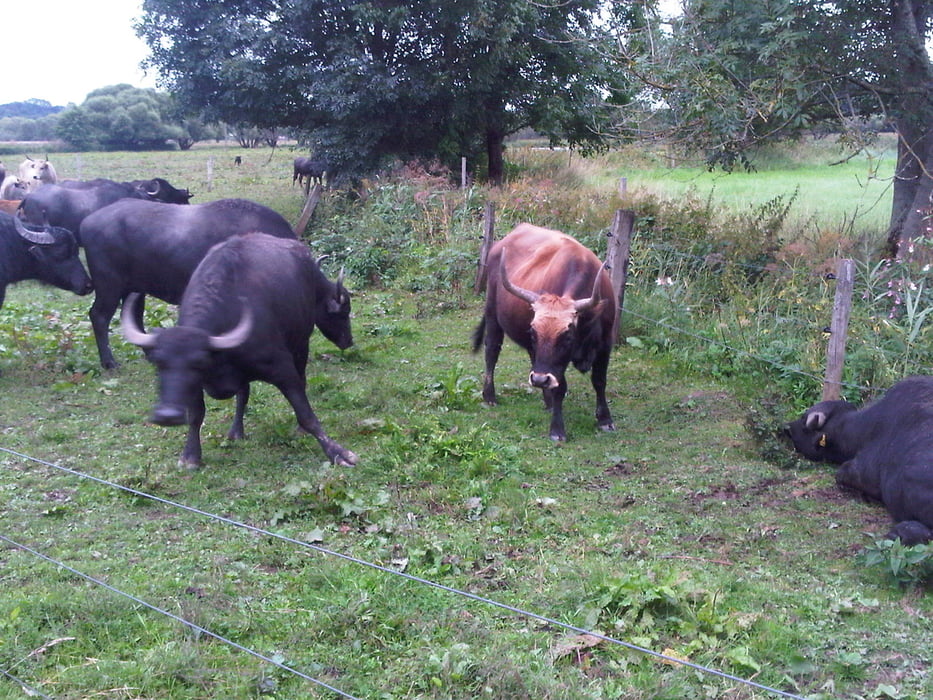
Dann noch an der L119 entlang um dann scharf abzuknicken um den schönen Radweg durch die Bliesau an den Rindern vorei zu nehmen.
Die Wasserbüffel stritten sich heftig, so dass einer etwas ausgenockt sich ausruhen musste. Der Eigentümer wurde informiert.
Der Rest war dann entspannt.
P.S. Die Störche waren heute noch da.
Further information at
https://de.wikipedia.org/wiki/Wasserb%C3%BCffelGalerija izletov
Zemljevid in višinski profil izleta
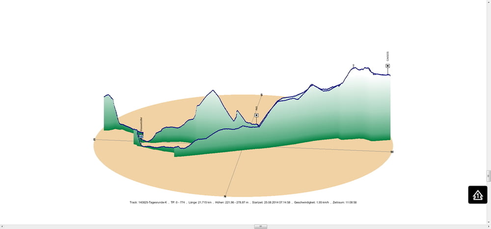
Minimum height 222 m
Maximum height 279 m
More about the tour author
|
|
Pheinz |
Komentarji

Start in Schwarzenbach.
Poti GPS
Trackpoints-
GPX / Garmin Map Source (gpx) download
-
TCX / Garmin Training Center® (tcx) download
-
CRS / Garmin Training Center® (crs) download
-
Google Earth (kml) download
-
G7ToWin (g7t) download
-
TTQV (trk) download
-
Overlay (ovl) download
-
Fugawi (txt) download
-
Kompass (DAV) Track (tk) download
-
List z izleti (pdf) download
-
Original file of the author (gpx) download
More about the tour author
|
|
Pheinz |
Add to my favorites
Remove from my favorites
Edit tags
Open track
My score
Rate