


Start in Schwarzenbach, das ein kleiner Ortsteil von Homburg ist. Auf einer mir schon wohlbekannten Strecke nach Kirkel-Neuhäusel.
Nach vollendetem Tagwerk fuhr ich bis zum Friedhof auf gleicher Strecke zurück um dann auf der Storchenroute unterhalb des Kirkeler Waldes nach Süden zu fahren.
In Lautzkirchen erreichte ich die Häuser und rollte dann hinter dem Bahnübergang auf der Nebenstraße bis in die "Stadtmitte von Blieskastel um mich über Winterklamotten für Bikes zu informieren. Auf dem Rückweg machte ich dann noch ein wenig Umsatz im REWE und rollte dann entspannt auf dem flachen Radweg bis zum Ausgangspunkt in Schwarzenbach zurück.
Further information at
https://de.wikipedia.org/wiki/Saarpfalz-KreisGalerija izletov


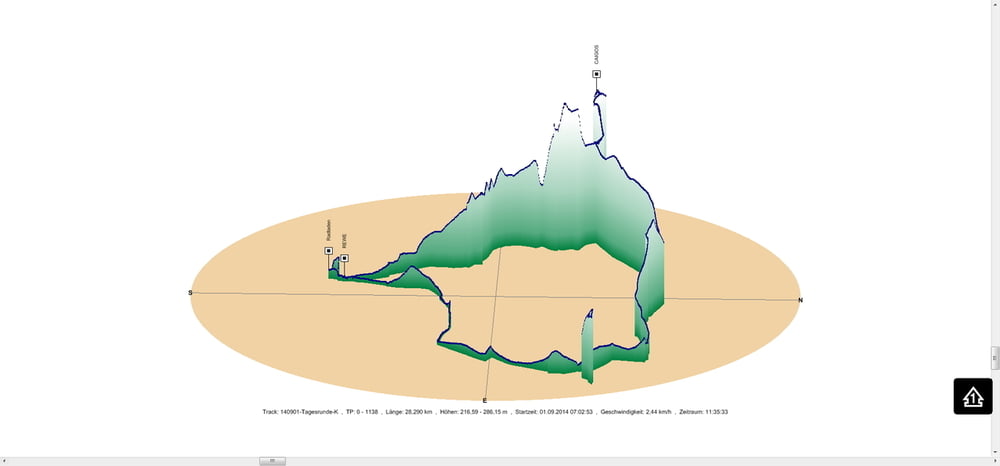
Zemljevid in višinski profil izleta
Minimum height 217 m
Maximum height 286 m
More about the tour author
|
|
Pheinz |
Komentarji

In Schwarzenbach geht es los, bzw. ist der Einstieg an jeder Stelle möglich.
Poti GPS
Trackpoints-
GPX / Garmin Map Source (gpx) download
-
TCX / Garmin Training Center® (tcx) download
-
CRS / Garmin Training Center® (crs) download
-
Google Earth (kml) download
-
G7ToWin (g7t) download
-
TTQV (trk) download
-
Overlay (ovl) download
-
Fugawi (txt) download
-
Kompass (DAV) Track (tk) download
-
List z izleti (pdf) download
-
Original file of the author (gpx) download
More about the tour author
|
|
Pheinz |
Add to my favorites
Remove from my favorites
Edit tags
Open track
My score
Rate