


wieder eine typische Runde zu meinem Tagwerk und zurück.
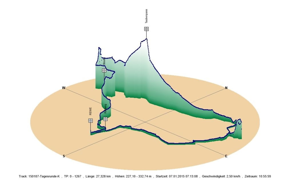
Ich fuhr von Schwarzenbach durch das Bliestal und danach das Taubental hoch über den Taubenpass nach Kirkel Neuhäusel.
Nach getaner Arbeit fuhr ich durch den Ortskern zur L113 um dann, den matschigen Radweg vermeidend, auf der Straße nach Lautzkirchen das Kirkeler Tal hinunter zu radeln. Hier schwenkte ich auf den Radweg ein um einen meiner Lieblingslädenin Blieskastel zu erreichen.
Nach meinem Einkauf des täglichen Bedarfs fuhr ich umgehend af dem Talradweg zum Ausgangspunkt nach Schwarzenbach zurück.
Further information at
https://de.wikipedia.org/wiki/Biosph%C3%A4renreservat_BliesgauGalerija izletov
Zemljevid in višinski profil izleta
Minimum height 227 m
Maximum height 333 m
More about the tour author
|
|
Pheinz |
Komentarji

In Schwarzenbach geht es los.
Poti GPS
Trackpoints-
GPX / Garmin Map Source (gpx) download
-
TCX / Garmin Training Center® (tcx) download
-
CRS / Garmin Training Center® (crs) download
-
Google Earth (kml) download
-
G7ToWin (g7t) download
-
TTQV (trk) download
-
Overlay (ovl) download
-
Fugawi (txt) download
-
Kompass (DAV) Track (tk) download
-
List z izleti (pdf) download
-
Original file of the author (gpx) download
More about the tour author
|
|
Pheinz |
Add to my favorites
Remove from my favorites
Edit tags
Open track
My score
Rate