


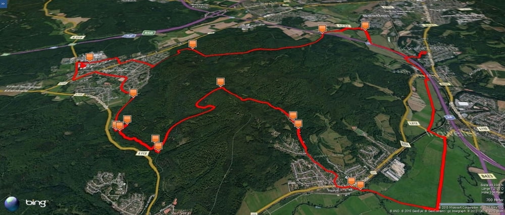
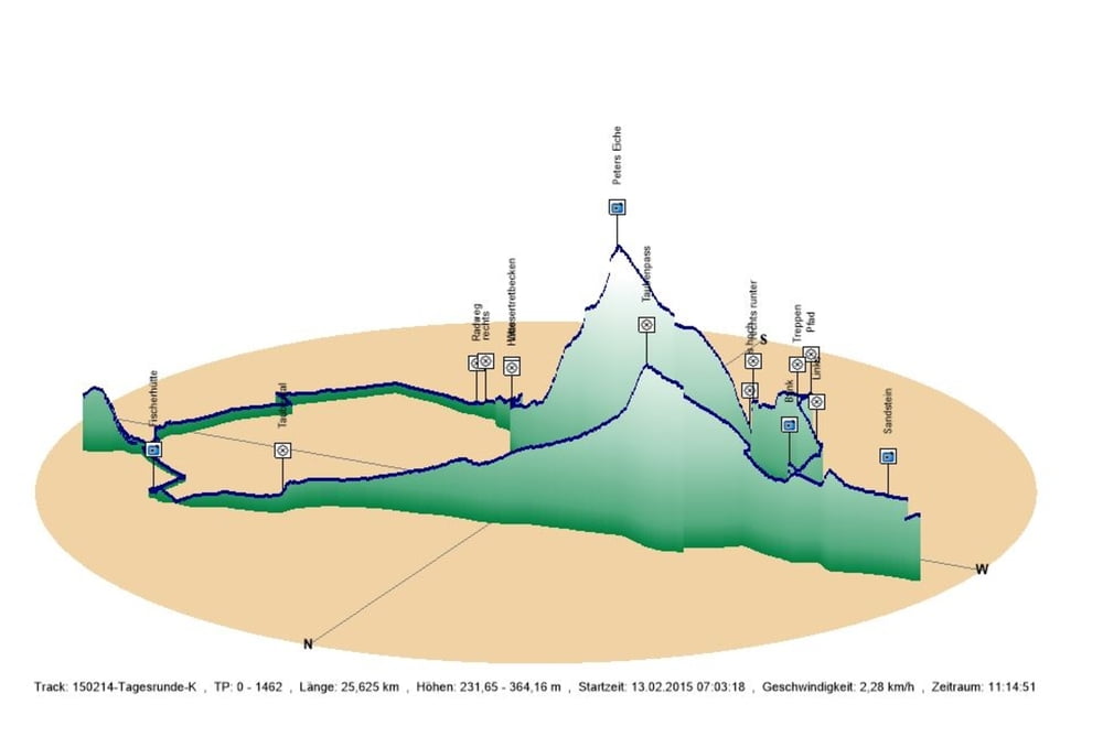
An diesem Tag führte mich mein Weg am Morgen von Schwarzenbach durch das Bliestal und durch das Taubental über den Pass nach Kirkel-Neuhäusel.
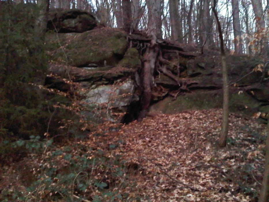
Auf meinem Weg zurück machte ich noch kurz am Kiosk in Kirkel-Neuhäusel Halt. Danach fuhr ich ein Stück auf dem Radweg in Richtung Lautzkirchen. Ich bog allerdings das kleine Tälchen nach links ab um dann bald auf den "Tafelweg nach rechts abzubiegen. Die paar Stufen schaffte ich nicht ganz hochzufahren. Dahinter schloss sich ein sehr schöner Wanderweg an den ich bis zum nächsten Tal das aus dem Kirkeler Wald herunterkommt verfolgte.
In diesem Tal führt ein Forstweg zu Peters Eiche. Diesmal nutzte ich Peters Eiche als Pass und fuhr gleich dahinter den Forstweg nach rechts in das Tal ab.
Ich passierte die Hütte und die im Winter geleerte Wassertretanlage und erreichte Bierbach an der Blies.
Von hier nahm ich für den restlichen Rückweg den im Tal verlaufenden Radweg bis Schwarzenbach.
Further information at
http://www.unesco.de/bliesgau.htmlGalerija izletov
Zemljevid in višinski profil izleta
Minimum height 232 m
Maximum height 364 m
More about the tour author
|
|
Pheinz |
Komentarji

In Schwarzenbach geht es los.
Poti GPS
Trackpoints-
GPX / Garmin Map Source (gpx) download
-
TCX / Garmin Training Center® (tcx) download
-
CRS / Garmin Training Center® (crs) download
-
Google Earth (kml) download
-
G7ToWin (g7t) download
-
TTQV (trk) download
-
Overlay (ovl) download
-
Fugawi (txt) download
-
Kompass (DAV) Track (tk) download
-
List z izleti (pdf) download
-
Original file of the author (gpx) download
More about the tour author
|
|
Pheinz |
Add to my favorites
Remove from my favorites
Edit tags
Open track
My score
Rate