


Auf meiner Lieblingsstrecke durch das Blies- und Taubental von Schwarzenbach nach Kirkel-Neuhäusel um dort meinen Tag zu verbringen.
Am Abend fuhr ich dann am Friedhof vorbei und dann auf dem Radweg von Kirkel-Neuhäusel zum Gewerbegebiet "An der Autobahn".
Hier links runter und unter der Bahn durch und bei den Hundefreunden vorbei nach Kirkel-Limbach . Ich nahm diesmal einen schönen Fuß- und Radweg am Ortsrand um dann nach einem kurzen Stück an der Straße bald nach rechts auf den Radweg an der Blies abzubiegen.
Ich passierte das Biotop und die Fischerhütte.
Gleich darauf war ich am Ausgangspunkt wieder angelangt.
Further information at
https://de.wikipedia.org/wiki/SaarlandGalerija izletov
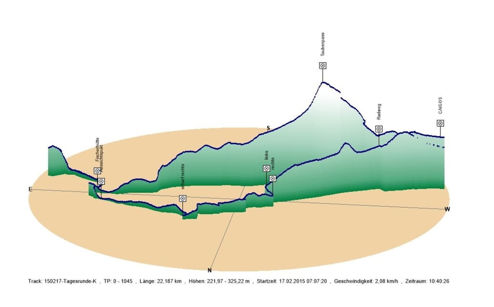
Zemljevid in višinski profil izleta
Minimum height 222 m
Maximum height 325 m
More about the tour author
|
|
Pheinz |
Komentarji

In Schwarzenbach geht es los.
Poti GPS
Trackpoints-
GPX / Garmin Map Source (gpx) download
-
TCX / Garmin Training Center® (tcx) download
-
CRS / Garmin Training Center® (crs) download
-
Google Earth (kml) download
-
G7ToWin (g7t) download
-
TTQV (trk) download
-
Overlay (ovl) download
-
Fugawi (txt) download
-
Kompass (DAV) Track (tk) download
-
List z izleti (pdf) download
-
Original file of the author (gpx) download
More about the tour author
|
|
Pheinz |
Add to my favorites
Remove from my favorites
Edit tags
Open track
My score
Rate