


Auf meinem Lieblingsweg durch die
Bliestalauund das Taubental nach
Kirkel-Neuhäusel.
Am späten Nachmittag dann zuerst ein Stück das Kirkeler Tal hinab und dann auf einem Forstweg ansteigend in den
hinein.
Durch Schlangenlinien, Irrungen und Wirrungen über gute und einen ziemlich anstrengenden Weg an Peters Eiche vorbei wieder zügig in das Bliestal hinab und durch die Ortslage von
. Ich blieb mit meiner havarierten Kette nun auf der Straße und fuhr erst später auf den Radweg der mich an Wörschweiler vorbei zu meinem Ausgangspunkt zurück brachte.
Further information at
https://de.wikipedia.org/wiki/BliesgauGalerija izletov


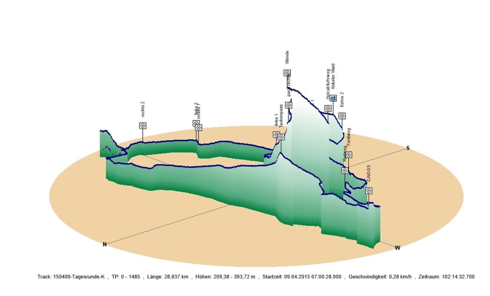
Zemljevid in višinski profil izleta
Minimum height 209 m
Maximum height 394 m
More about the tour author
|
|
Pheinz |
Komentarji

Start in Schwarzenbach.
Poti GPS
Trackpoints-
GPX / Garmin Map Source (gpx) download
-
TCX / Garmin Training Center® (tcx) download
-
CRS / Garmin Training Center® (crs) download
-
Google Earth (kml) download
-
G7ToWin (g7t) download
-
TTQV (trk) download
-
Overlay (ovl) download
-
Fugawi (txt) download
-
Kompass (DAV) Track (tk) download
-
List z izleti (pdf) download
-
Original file of the author (gpx) download
More about the tour author
|
|
Pheinz |
Add to my favorites
Remove from my favorites
Edit tags
Open track
My score
Rate