


Am Morgen fuhr ich durch das Blies- und Taubental über den Taubenpass nach Kirkel-euhäusel wo ich meinen Tag verbrachte.
Am Abend radelte ich an der ARAL-Tankstelle in Kirkel vorbei um meine Luft zu prüfen. Danach fuhr ich den etwas steileren Weg auf den Taubenpass hinauf um dann den Forstweg auf der Höhe nach Osten zu radeln.
Nach der schönen Abfahrt hielt ich mich links und dann über die Autoban weil ich noch bei Netto etwas benötigte.
Den Rest fuhr ich dann auf dem schönen Radweg im Tal der Blies zurück nach Schwarzenbach.
.
Further information at
https://de.wikipedia.org/wiki/KirkelGalerija izletov
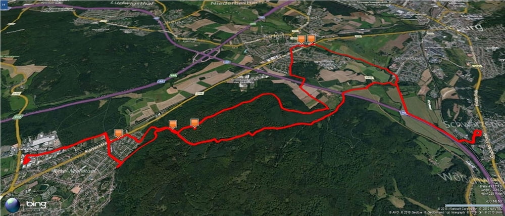

Zemljevid in višinski profil izleta
Minimum height 228 m
Maximum height 369 m
More about the tour author
|
|
Pheinz |
Komentarji

Start und Ziel in Schwarzenbach.
Poti GPS
Trackpoints-
GPX / Garmin Map Source (gpx) download
-
TCX / Garmin Training Center® (tcx) download
-
CRS / Garmin Training Center® (crs) download
-
Google Earth (kml) download
-
G7ToWin (g7t) download
-
TTQV (trk) download
-
Overlay (ovl) download
-
Fugawi (txt) download
-
Kompass (DAV) Track (tk) download
-
List z izleti (pdf) download
-
Original file of the author (gpx) download
More about the tour author
|
|
Pheinz |
Add to my favorites
Remove from my favorites
Edit tags
Open track
My score
Rate