


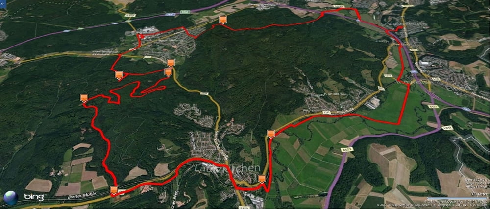
Auf meiner Lieblingsstrecke durch das Blies- und Taubental nach Kirkel-Neuhäusel.
Am Abend rollte ich zuerst zum Kreisverkehr bei dem Café Kreisel vorbei und fuhr bis zum westlichen Ortsende wo ich in den westlichen Kirkeler-Wald einfuhr.
Nachdem ich nach links abgebogenwar suchte ich einen neuen Weg. Er erwies sich als Sackgasse. Er endete an einer alten Baumruine die mit Baumpilzen übersäht war.
Ich kehrte zum Hauptweg zurück und fuhr zur L113. Hier bog ich auf einen schmalen Trial ein der mich paralell zur Straße zu einem Waldparkplatz führte. Hier nahm ich den schön hergerichteten Forstweg der mich den Berg hochführte.
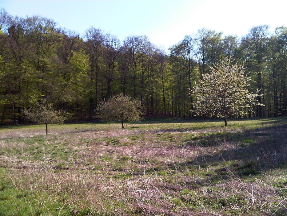
Nach einigen Kurven gelangte ich auf die Anhöhe und konnte nun an einer Waldwiese vorbei zur L111 zwischen Niederwürzbach und Lautzkirchen gelangen.
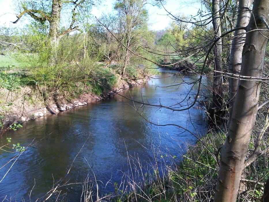
Bei Gegenwind fuhr ich im Tal der Blies zurück nach Schwarzenbach.
Am Abend rollte ich zuerst zum Kreisverkehr bei dem Café Kreisel vorbei und fuhr bis zum westlichen Ortsende wo ich in den westlichen Kirkeler-Wald einfuhr.
Nachdem ich nach links abgebogenwar suchte ich einen neuen Weg. Er erwies sich als Sackgasse. Er endete an einer alten Baumruine die mit Baumpilzen übersäht war.
Ich kehrte zum Hauptweg zurück und fuhr zur L113. Hier bog ich auf einen schmalen Trial ein der mich paralell zur Straße zu einem Waldparkplatz führte. Hier nahm ich den schön hergerichteten Forstweg der mich den Berg hochführte.
Nach einigen Kurven gelangte ich auf die Anhöhe und konnte nun an einer Waldwiese vorbei zur L111 zwischen Niederwürzbach und Lautzkirchen gelangen.
Bei Gegenwind fuhr ich im Tal der Blies zurück nach Schwarzenbach.
Further information at
https://de.wikipedia.org/wiki/BliesgauGalerija izletov
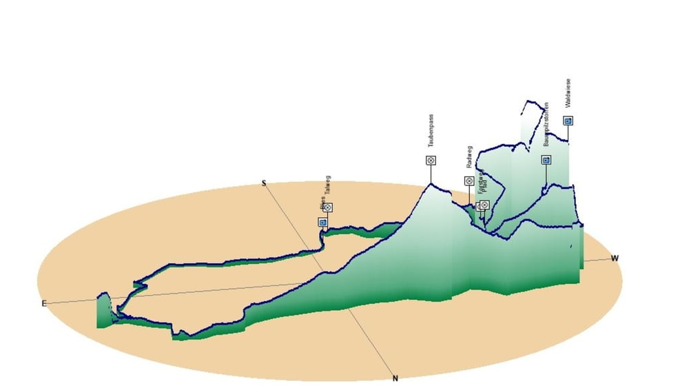
Zemljevid in višinski profil izleta
Minimum height 231 m
Maximum height 361 m
More about the tour author
|
|
Pheinz |
Komentarji

Start und Ziel in Schwarzenbach.
Poti GPS
Trackpoints-
GPX / Garmin Map Source (gpx) download
-
TCX / Garmin Training Center® (tcx) download
-
CRS / Garmin Training Center® (crs) download
-
Google Earth (kml) download
-
G7ToWin (g7t) download
-
TTQV (trk) download
-
Overlay (ovl) download
-
Fugawi (txt) download
-
Kompass (DAV) Track (tk) download
-
List z izleti (pdf) download
-
Original file of the author (gpx) download
More about the tour author
|
|
Pheinz |
Add to my favorites
Remove from my favorites
Edit tags
Open track
My score
Rate