


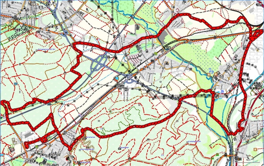
Ich fuhr am Morgen entspannt durch das Blies- und Taubental nach Kirkel-Neuhäusel.
Am Abend schaute ich nach der Brückenbaustelle in Kirkel. Momentan ist der Übergang zur Kaiserstraße unmöglich. Die Brücke wird neu gebaut. Deshalb radelte ich am Friedhof hoch und zickzackte durch den Wald um dann nördlich der A6 nach Bayerisch Kohlhof zu fahren. Die Passage durch dieses Gebiet war wirklich schön.
Dann fuhr ich auf der Straße durch Kirkel und die Kirkeler Altstadt um dann östlich in die Feldlage zu gelangen.
In Homburg angelangt fuhr ich die Beeder Straße an Beeden vorbei nach Schwarzenbach.
Further information at
http://www.homburg.de/content/pages/home.htmGalerija izletov
Zemljevid in višinski profil izleta
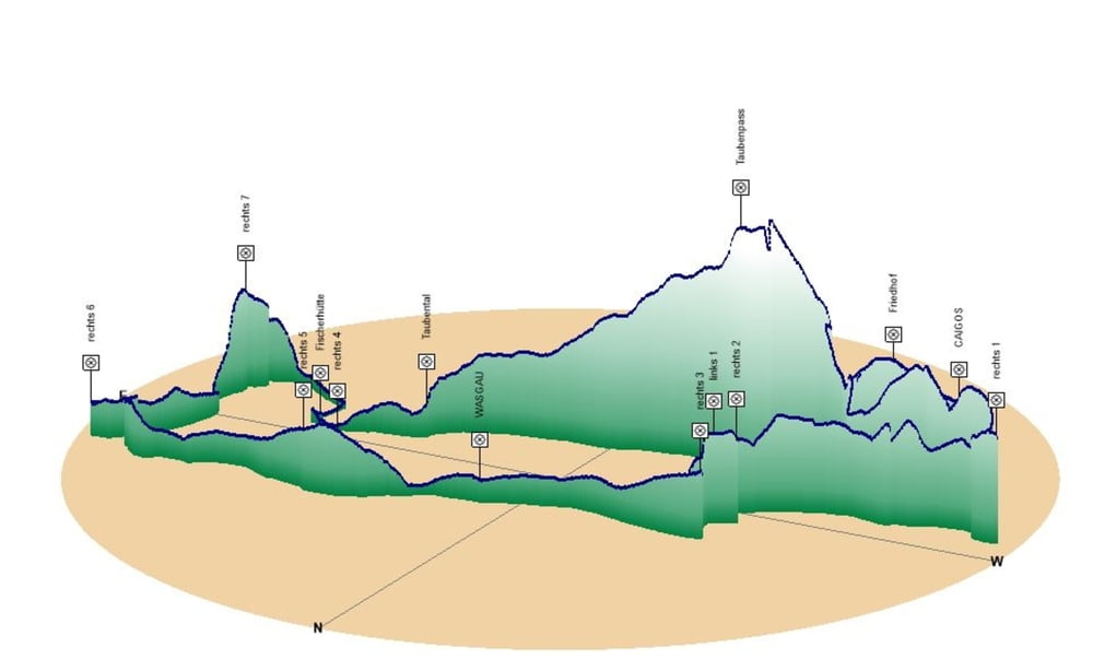
Minimum height 222 m
Maximum height 326 m
More about the tour author
|
|
Pheinz |
Komentarji

Startund Ziel in Schwarzenbach.
Poti GPS
Trackpoints-
GPX / Garmin Map Source (gpx) download
-
TCX / Garmin Training Center® (tcx) download
-
CRS / Garmin Training Center® (crs) download
-
Google Earth (kml) download
-
G7ToWin (g7t) download
-
TTQV (trk) download
-
Overlay (ovl) download
-
Fugawi (txt) download
-
Kompass (DAV) Track (tk) download
-
List z izleti (pdf) download
-
Original file of the author (gpx) download
More about the tour author
|
|
Pheinz |
Add to my favorites
Remove from my favorites
Edit tags
Open track
My score
Rate