


Ich fuhr zuerst einmal wieder durch das Blies- und Taubental nach Kirkel-Neuhäusel.
Am Abend kullerte ich durch Neuhäusel um am südlichen Ortsrand das Kirkeler Tal zu befahren. Ich blieb nicht lange auf dem gekiesten Radweg, sondern bog nach links auf einen Pfad ab den ich bald nach links verliess um auf der Tafeltour auf halber Höhe wieder nach Norden zu fahren.
Immer wieder hat man tolle Ausblicke auf Kirkel und die Burg währen der Weg die eine oder andere knifflige Stelle bereithält.
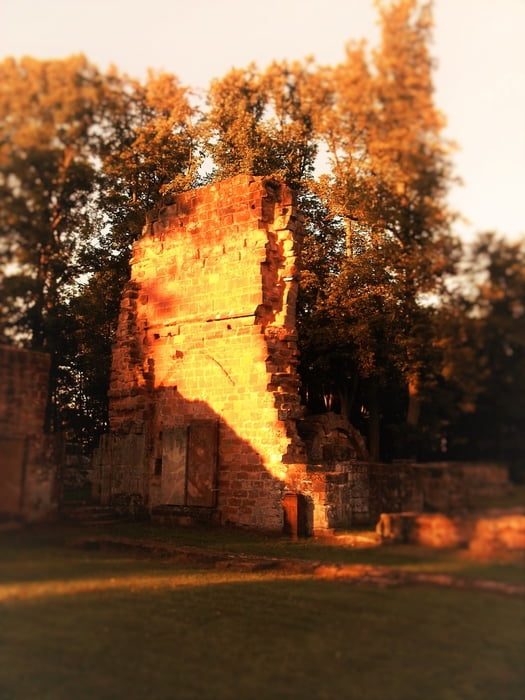
Am Wasserfelsen angekommen verfolgte ich den Forstweg in Richtung Frauenbrunnen und dann weiter nach Westen über die 7 Fichten und dann noch zum alten Kloster Wörschweiler.
Zum Abschluss rollte ich noch den breiten Weg nach Wörschweiler hinunter und dann zu meinem Start- und Zielpunkt.
Further information at
https://de.wikipedia.org/wiki/Saarpfalz-KreisGalerija izletov


Zemljevid in višinski profil izleta
Minimum height 227 m
Maximum height 374 m
More about the tour author
|
|
Pheinz |
Komentarji

Start und Ziel in Homburg Schwarzenbach.
Poti GPS
Trackpoints-
GPX / Garmin Map Source (gpx) download
-
TCX / Garmin Training Center® (tcx) download
-
CRS / Garmin Training Center® (crs) download
-
Google Earth (kml) download
-
G7ToWin (g7t) download
-
TTQV (trk) download
-
Overlay (ovl) download
-
Fugawi (txt) download
-
Kompass (DAV) Track (tk) download
-
List z izleti (pdf) download
-
Original file of the author (gpx) download
More about the tour author
|
|
Pheinz |
Add to my favorites
Remove from my favorites
Edit tags
Open track
My score
Rate