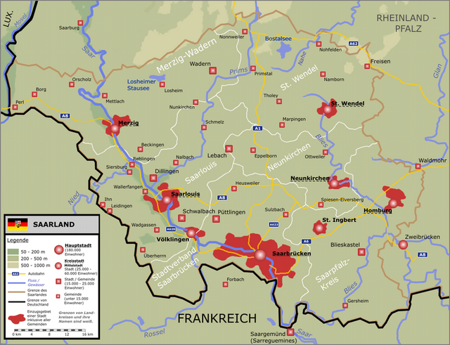
Mehrtagestour an der Außengrenze des Saarlandes- Gesamtsrecke ca. 360 km
es fehlt bei dieser Route die Strecke von Niedaltdorf über Perl / Nennig bis Tettingen-Butzdorf !
wegen aktuellen Baustellen (23.08.08) einige Umleitungen die gut ausgeschildert waren bis auf den Bereich Nonnweiler
- Stausee wo am Parkplatz Hunnenring die Wegweiser durch die dort arbeitenden Firmen demontiert wurden
Further information at
http://www.tourismus.saarland.de/urlaubsfinder/aktivurlaub/496_DEU_tzs.phpZemljevid in višinski profil izleta
Minimum height 159 m
Maximum height 588 m
Komentarji

Poti GPS
Trackpoints-
GPX / Garmin Map Source (gpx) download
-
TCX / Garmin Training Center® (tcx) download
-
CRS / Garmin Training Center® (crs) download
-
Google Earth (kml) download
-
G7ToWin (g7t) download
-
TTQV (trk) download
-
Overlay (ovl) download
-
Fugawi (txt) download
-
Kompass (DAV) Track (tk) download
-
List z izleti (pdf) download
-
Original file of the author (gpx) download
Add to my favorites
Remove from my favorites
Edit tags
Open track
My score
Rate

