


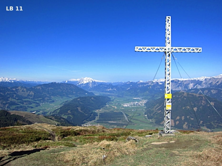
Der Wanderweg Nr.652 von Rottenmann auf das Dürrenschöberl beginnt bei der Feuerwehr in Rottenmann. Dort gibt es für einige Autos eine Parkmöglichkeit. Nach der Eisenbahnüberführung geht man 50m Meter in östliche Richtung. Hier beginnt ein 300m langer und steiler Abschnitt über eine Wiese bis zur Forststraße. Wer es am Anfang ein bisschen gemütlicher haben möchte kann diesen Teil laut der hellgrünen Linie in der Google Map umgehen (+ ca.400m). Ab hier wandert man stetig weiter bergauf, immer wieder die Forststraße querend. Schließlich führt eine Forststraße oberhalb des Löffelmacherbaches zur Messneralm (1478m).
mehr Infos und Fotos findest du auf biketours4you.at
The hiking trail Nr.652 to the mountain Dürrenschöberl begins in Rottenmann at the fire department. There are also some parking spot. After the railway bridge you’ll hike 50m to the east. Here begins a 300m long, steep section on a meadow up to the forest road. Who want have it at the beginning a bit comfortable can go along the light green line in the Google Map (+ 400 m away). From here you walk steadily uphill, repeatedly traversing the forest road. Finally, a forest road leads to the Messneralm (1478m).
more infos and photos you'll see on biketours4you.at
Galerija izletov
Zemljevid in višinski profil izleta
Minimum height 678 m
Maximum height 1740 m
More about the tour author
|
|
Trek1400d |
Komentarji

Poti GPS
Trackpoints-
GPX / Garmin Map Source (gpx) download
-
TCX / Garmin Training Center® (tcx) download
-
CRS / Garmin Training Center® (crs) download
-
Google Earth (kml) download
-
G7ToWin (g7t) download
-
TTQV (trk) download
-
Overlay (ovl) download
-
Fugawi (txt) download
-
Kompass (DAV) Track (tk) download
-
List z izleti (pdf) download
-
Original file of the author (gpx) download
More about the tour author
|
|
Trek1400d |
Add to my favorites
Remove from my favorites
Edit tags
Open track
My score
Rate