Login

Si pozabil/a podatke za prijavo?

Cookies have to be accepted!
Your browser's cookie functionality is disabled. Please enable this functionality.

Not a member yet?

Register now
Login

Available for registred users only

Log in to use this feature.

Si pozabil/a podatke za prijavo?

Cookies have to be accepted!
Your browser's cookie functionality is disabled. Please enable this functionality.

Not a member yet?

Register now
Filter
Kategorije
Advanced filters
  • Dolžina (km)
  • Metri nadmorske višine
Shrani filter Reset filter

TrackRank

QRCode

Technical data

Dolžina10,0 km Metri nadmorske višine693 m Way down691 m Trajanje04:00 h:m Datum31.05.2011
Ocene Author Pokrajina Dejavnik zabave Kondicija Tehnika

Statistika

466 Pogledi Ocene 68 Prenosi Povprečje
Rate
  • List z izleti
  • Prihod
  • Prenosi

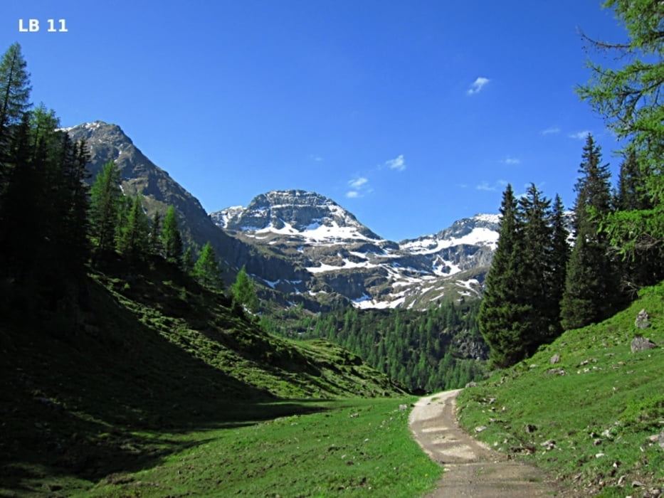
Die Wanderung zum Duisitzkarsee in der Nähe von Schladming im Obertal der Gemeinde Rohrmoos – Untertal ist besonders ab Juni bis Oktober sehr empfehlenswert. Alternativ zum mittelschweren Wanderweg gibt es auch eine Forststraße bis zur Duisitzkarseehütte und Fahrlechhütte. Besonders schön ist es windstillen Tagen, da sich die umliegenden Berge im See spiegeln.


Galerija izletov

Zemljevid in višinski profil izleta

  • Open Street Map
  • Google
Minimum height 1204 m Maximum height 1760 m Prikaz podrobnosti

More about the tour author

Trek1400d
Member since 2008

Send private message

Komentarji

Poti GPS

Trackpoints
  • GPX / Garmin Map Source (gpx) download
  • TCX / Garmin Training Center® (tcx) download
  • CRS / Garmin Training Center® (crs) download
  • Google Earth (kml) download
  • G7ToWin (g7t) download
  • TTQV (trk) download
  • Overlay (ovl) download
  • Fugawi (txt) download
  • Kompass (DAV) Track (tk) download
  • List z izleti (pdf) download
  • Original file of the author (gpx) download

More about the tour author

Trek1400d
Member since 2008

Send private message
Share track
Add to my favorites
Remove from my favorites
Edit tags
My score
Rate
Izlet: Duisitzkarsee
Vrsta: Pešačenje
Dolžina: 10,0 km
Evaluated on:
Trajanje:
Day(s)
Hour(s)
Minute(s)
Ocena: Pokrajina Dejavnik zabave Kondicija Tehnika