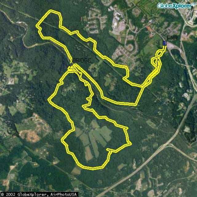
Poor drainage makes this ride horrible within 4 days of any rain, so take note. But, if there's a drought, you better make the time for this ride because it is awesome. Intermediates will enjoy the ride, and experts will love it! as long as somebody can stop M.O.R.E (a local club) from removing all the challenges of the ride. They tend to be overzealous in creating mountain biking everyone can enjoy at the expense of any advanced riders looking for a challenge.
Další informace v části
http://www.raidoh.comTrasa mapa a výškový profil
Minimální výška -24 m
Maximální výška 128 m
Komentáře

To get to the Park-N-Ride, from I95, take the Catonsville MD166 Exit and follow the signs to the PNR. Landing Road is more complicated. From I95, take MD100 East. Go North on MD Rt 1 and take a left on Montgomery Road. Right on Landing Road. Go 4 miles, trails are on the right, new houses are on the left. A street name should be posted soon.
Trasy GPS
Trackpoints-
GPX / Garmin Map Source (gpx) download
-
TCX / Garmin Training Center® (tcx) download
-
CRS / Garmin Training Center® (crs) download
-
Google Earth (kml) download
-
G7ToWin (g7t) download
-
TTQV (trk) download
-
Overlay (ovl) download
-
Fugawi (txt) download
-
Kompass (DAV) Track (tk) download
-
Formulář trasy (pdf) download
-
Původní soubor autora (g7t) download
Přidat do oblíbených
Odebrat z oblíbených položek
Upravit značky
Open track
Moje hodnocení
Hodnotit


