
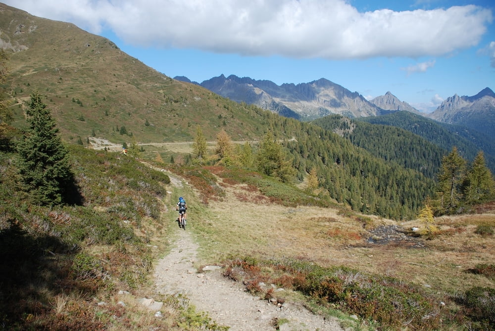

È un tour tecnico e abbastanza impegnativo, per il quale sono previsti due giorni di marcia.
Il percorso parte da Strigno, continua verso l’abitato di Spera e percorre poi tutta la strada asfaltata per la Val Campelle fino al ponte di Conseria. Da qui si sale lungo la strada sterrata fino al passo Cinque Croci scendendo poi per tutta la Val Cia fino al rifugio Refavaie. Da qui si continua su strada asfaltata lungo un tratto della Val Caoria costeggiando il torrente Vanoi fino ad incrociare la strada provinciale che porta al Passo Brocon con una serie di tornanti. Una volta raggiunto il Passo si scende su strada sterrata lungo la Val Senaiga passando vicino alle grotte di Castello Tesino, la quale porta al Parco la Cascatella ; da qui si continua fino all’abitato di Castello T. per poi giungere a Pieve T. e continuare la marcia verso il passo La Forcella; da qui in poi su strada sterrata si scende fino all’abitato di Strigno.
243 Tour um den Berggipfel Cima d’Asta
Hierbei handelt es sich um eine sehr anstrengende Tour mit viel Technik, für die man 2 Tage braucht.
Die Tour beginnt in Strigno, geht weiter in Richtung Spera und dann auf asphaltierter Straße bis ins Val Campelle und zur Brücke Ponte di Conseria. Von hier aus fährt man bergab, auf einem Waldweg, bis zum Bergpass Cinque Croci, durch das ganze Val Cia und bis zur Berghütte Refavaie. Auf einer asphaltierten Straße im Val Caoria, am Bach Vanoi entlang, erreicht man dann die Kreuzung mit der Provinzstraße, die über eine Reihe von Kehren zum Bergpass Brocon führt. Einmal am Pass angekommen, geht es auf einem Waldweg durch das Val Senaiga, dabei kommt man in die N ähe der Grotte von Castello Tesino und erreicht den Park la Cascatella; von hier aus fährt man bis zum Ort Castello Tesino und weiter bis nach Pieve Tesino und im Anschluss bis zur Gabelung dem Pass La Forcella; von hier aus geht es auf einer Schotterstraße bis zum Ort Strigno.
243 Cima D’Asta Tour
A technical and demanding tour, planned for a two-day march. The route starts from Strigno, continues up to Spera and runs along the paved road in Val Campelle up to Conseria bridge. From here, ride on the dirt road up to Passo Cinque Croci, then descent Val Cia to Rifugio Refavaie. The route continues on asphalt road along a part of Val Caoria, along the stream Vanoi until you cross the road with switchbacks that leads to Passo Brocon. When you reach Passo Brocon, ride down on a dirt road along Val Senaiga, pass near the Castello Tesino caves and to La Cascatella park. Then continue until Castello T. to Pieve T., bike up to Passo La Forcella; from here on, the paved road continues to Strigno.
Trasa mapa a výškový profil
Minimální výška 459 m
Maximální výška 2031 m
Více o autorovi turné

|
valsuganaapt |
Komentáře

Trasy GPS
Trackpoints-
GPX / Garmin Map Source (gpx) download
-
TCX / Garmin Training Center® (tcx) download
-
CRS / Garmin Training Center® (crs) download
-
Google Earth (kml) download
-
G7ToWin (g7t) download
-
TTQV (trk) download
-
Overlay (ovl) download
-
Fugawi (txt) download
-
Kompass (DAV) Track (tk) download
-
Formulář trasy (pdf) download
-
Původní soubor autora (gpx) download
Více o autorovi turné
|
|
valsuganaapt |
Přidat do oblíbených
Odebrat z oblíbených položek
Upravit značky
Open track
Moje hodnocení
Hodnotit