Die 32,8 km lange MTB Tour Schüttbauernalm befindet sich in der sehr schönen Landschaft des Nationalparks Kalkalpen. Sie ist mit 1.186 Höhenmetern konditionell recht anspruchsvoll, weist aber keinerlei technische Schwierigkeiten auf.
Da wir zu dieser MTB Tour mit dem Zug angereist sind, beginnt die Tour beim Bahnhof in Weißenbach an der Enns. Zuerst fahren wir auf der Buchauer Straße durch Weißenbach an der Enns und bei der Ortsende Tafel biegen wir nach ca. 1,5 km nach rechts ab. Wesentlich flacher und mit viel weniger Verkehr geht es nun durch den Ortsteil Spitzenbach weiter. Wer möchte kann auch durch St. Gallen fahren und kurz nach dem Hauptplatz über das Bergerviertel wieder zu dieser MTB Tour zurückkehren. Der asphaltierte Pfarreralm Weg führt nach Breitau hinauf. Bei Kilometer 8,4 biegen wir nach links zum Radweg über den Totenkogel ab. Zum ersten Mal auf dieser Tour fährst du dann auf einem Forstweg. Nach einer 1,2 km langen 10%igen Steigung geht es dann allmählich wieder bergab und bei Kilometer 13,4 erreichen wir den kleinen Ort Unterlaussa 550m. Nach der Überquerung des Laussabachs führt die Tour auf der Landesstraße L550 rund 3,5 km weiter in Richtung Altenmarkt bei St. Gallen und biegt dann nach links ab.
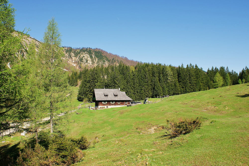
500m später beginnt die Schotterstraße auf der wir nun die nächsten 4,5 Kilometer zur Schüttbauernalm 1.055m hinauffahren. Dabei gibt es längere Abschnitte mit einer durchschnittlichen Steigung von ca. 14%. Die sehr gut geführte Hütte lädt von Mittwoch bis Sonntag zur Einkehr ein. Man kann hier sogar übernachten und die gegenüber aufragende Buchsteingruppe im Morgenlicht bestaunen. Da auch einige Wanderer und Hüttenbesucher mit dem Auto bis zur Schüttbauernalm hinauffahren, bitte auf der Talfahrt immer auf Sicht fahren. Wieder im Tal angekommen fahren wir wieder auf der L550 in Richtung Altenmarkt bei St. Gallen und bleiben das nächste Mal am Beginn der Ennsbrücke stehen. Ein paar Meter neben der Brücke mündet der Laussabach mit einem kleinen, sehenswerten Wasserfall in die Enns. Die letzten drei Kilometer geht es noch der Enns entlang flussaufwärts und nach 32,8 Kilometer endet die schöne MTB Tour beim Bahnhof in Weißenbach an der Enns.
The 32.8 km long mountain bike tour Schüttbauernalm is located in the beautiful National Park Limestone Alps. The tour is with 1.186 vertical meters quite challenging, but has no technical difficulties.
As we arrived by train we start the tour at the train station in Weißenbach an der Enns. First we drive on the road - Buchauer Straße through Weissenbach an der Enns and at the end of the village, we turn right after about 1.5 km. Now we bike much flatter and with much less traffic through the district - Spitzenbach. Who want can also drive through the main town - St. Gallen and return to this mountain bike tour shortly after the main square uphill through the district - Bergerviertel. The paved path - Pfarreralmweg lead us up to Breitau. At km 8.4 you must turn left onto the mtb path – Totenkogel. For the first time on this tour you’ll drive on a forest road. After 1.2 km with 10% incline it goes gradually downhill and at km 13.4 we reach the small town – Unterlaussa at a high of 550m. After crossing the stream - Laussabach the tour lead us on the country road L550 about 3.5 km towards the village Altenmarkt bei St. Gallen and then we turn left.
500m later, the gravel road begins and we go up on the next 4.5 km to the managed hut - Schüttbauernalm 1.055m. There are long sections with an average gradient of about 14%. The lodge is open from Wednesday to Sunday for a good rest. Since some hikers and cottage visitors drive up by car to the Schüttbauernalm, please drive down slowly and carefully. Back in the valley we go back to the L550 towards Altenmarkt bei St. Gallen and stay the next time at the beginning of the Enns bridge. A few meters away from the bridge the stream Laussabach flows with a small, remarkable waterfall in the river Enns. The last three kilometers are still along the Enns River upstream and after 32.8 km the beautiful mountain bike tour ends at the train station in Weissenbach an der Enns.
Galerie tras
Trasa mapa a výškový profil
Komentáře

Trasy GPS
Trackpoints-
GPX / Garmin Map Source (gpx) download
-
TCX / Garmin Training Center® (tcx) download
-
CRS / Garmin Training Center® (crs) download
-
Google Earth (kml) download
-
G7ToWin (g7t) download
-
TTQV (trk) download
-
Overlay (ovl) download
-
Fugawi (txt) download
-
Kompass (DAV) Track (tk) download
-
Formulář trasy (pdf) download
-
Původní soubor autora (gpx) download


