Přihlášení

Zapomenutý login?

Soubory cookie musí být akceptovány!
Funkce cookies ve vašem prohlížeči je deaktivována. Aktivujte prosím tuto funkci.

Ještě nejste členem?

Zaregistrujte se nyní
Přihlášení

Možné pouze pro přihlášené uživatele

Přihlaste se, abyste mohli tuto funkci používat.

Zapomenutý login?

Soubory cookie musí být akceptovány!
Funkce cookies ve vašem prohlížeči je deaktivována. Aktivujte prosím tuto funkci.

Ještě nejste členem?

Zaregistrujte se nyní
Filtr
Kategorie
Pokročilé filtry
  • Délka (km)
  • Výškoměr
Uložit filtr Obnovit filtr

TrackRank

QRCode

Technické údaje

Délka41,2 km Výškoměr840 m Sestup835 m Doba03:00 h:m Datum14.06.2008
Hodnocení Autor Krajina Faktor zábavy Náročnost Technika

Statistika

4239 Přehledy 1 Hodnocení 402 Downloady 5.00 Průměr
Hodnotit
  • Formulář trasy
  • Příjezd
  • Downloady

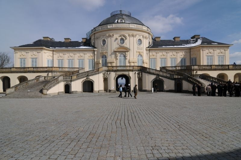
Tour führt von Stuttgart Kräherwaldstrasse rechts an Botnang vorbei in Richtung Schloss Solitude. Schloss Solitude streifend auf einem netten Single Trail in Richtung Brücke über die Wildparkstrasse. Von hier aus die Anfahrt Richtung favorisierten Single Trail am Bärensee. Diesen beendet nun in Richtung Katzenbacher See. Katzenbacher Hof in Sichtweite lassend wieder auf den Weg in Richtung Neuer See am Bärenschlössle. Von hier geht es ohne Umwege Richtung Stuttgart West über die B14 in Richtung Stuttgart Süd. Über eine schnelle Abfahrt mit 5`fachen Sprungmöglichkeiten gehts dann in Richtung Kaltental. Vor Kaltental jedoch wieder Berg auf zum Waldfriedhof. Vom Waldfriedhof rechts am Dornhaldenfriedhof über eine anspruchsvolle sehr grob geschotterte Auffahrt in Richtung Haltestelle Zahnradbahn, diese stellenweise mit Single Trail einlagen.

Von hier fahren wir über Teilabschnitte der Downhillstrecke in den Stuttgarter Kessel. Die Stadt über die Tübinger Strasse durchkreuzend in Richtung Liederhalle. Von hier wieder zum Ausgangspunkt (Stuttgart Kräherwald).

Galerie tras

Trasa mapa a výškový profil

  • Open Street Map
  • Google
Minimální výška 258 m Maximální výška 506 m Detailní náhled

Více o autorovi turné

scotthunter
Členem od 2008

Odeslat soukromou zprávu

Komentáře

Lutze on 20.10.2008

Tour

Also ein wirlich schöne und abwechslungsreiche Tour. Jetzt im Herbst und bei dem tollen Sonnenschein - war waren hin und weg. Dankeschön

Trasy GPS

Trackpoints
  • GPX / Garmin Map Source (gpx) download
  • TCX / Garmin Training Center® (tcx) download
  • CRS / Garmin Training Center® (crs) download
  • Google Earth (kml) download
  • G7ToWin (g7t) download
  • TTQV (trk) download
  • Overlay (ovl) download
  • Fugawi (txt) download
  • Kompass (DAV) Track (tk) download
  • Formulář trasy (pdf) download
  • Původní soubor autora (gpx) download

Více o autorovi turné

scotthunter
Členem od 2008

Odeslat soukromou zprávu
Share track
Přidat do oblíbených
Odebrat z oblíbených položek
Upravit značky
Moje hodnocení
Hodnotit
Trasa: Stuttgart-NW -> Solitude -> Katzenbacher Hof ->Stuttgart-NW
Druh: Horské kolo
Délka: 41,2 km
Hodnoceno na:
Doba:
Den(y)
Hodina(y)
Minuta(y)
Hodnocení: Krajina Faktor zábavy Náročnost Technika