Přihlášení

Zapomenutý login?

Soubory cookie musí být akceptovány!
Funkce cookies ve vašem prohlížeči je deaktivována. Aktivujte prosím tuto funkci.

Ještě nejste členem?

Zaregistrujte se nyní
Přihlášení

Možné pouze pro přihlášené uživatele

Přihlaste se, abyste mohli tuto funkci používat.

Zapomenutý login?

Soubory cookie musí být akceptovány!
Funkce cookies ve vašem prohlížeči je deaktivována. Aktivujte prosím tuto funkci.

Ještě nejste členem?

Zaregistrujte se nyní
Filtr
Kategorie
Pokročilé filtry
  • Délka (km)
  • Výškoměr
Uložit filtr Obnovit filtr

TrackRank

QRCode

Technické údaje

Délka8,1 km Výškoměr277 m Sestup288 m Doba02:30 h:m Datum31.10.2019
Hodnocení Autor Krajina Faktor zábavy Náročnost Technika

Statistika

282 Přehledy Hodnocení 30 Downloady Průměr
Hodnotit
  • Formulář trasy
  • Příjezd
  • Downloady

Die Wanderung ist nicht sehr anstrengend und gut zu laufen. Es ist eine offizielle und gut ausgeschilderte Wanderung (Sendero 2 – Arenas Negras). Die Wegfindung ist deshalb problemlos.


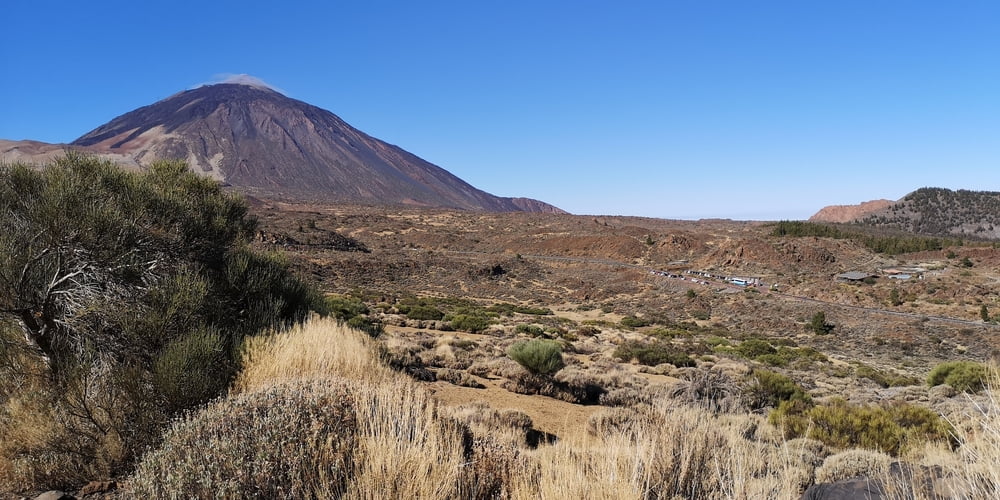
Start ist beim Besucherzentrum (Centro de Visitantes de El Portillo 2034 m). Man befindet sich über den Passatwolken und hat oft einen Blick auf den Teide. Je nachdem wie man die Rundwanderung geht muss man sich dafür mal umdrehen. Es ist eine Wanderung ohne Schatten!


Weitere Infos: http://www.teide-nationalpark.de/wandern-teide-nationalpark/wanderwege-teide-nationalpark/sendero-2-arenas-negras


Galerie tras

Trasa mapa a výškový profil

  • Open Street Map
  • Google
Minimální výška 2064 m Maximální výška 2325 m Detailní náhled

Více o autorovi turné

JoachimDief
Členem od 2016

Odeslat soukromou zprávu

Komentáře

Parkplatz am der Straßenkreuzung El Portillo an der TF-21/TF-24. Hier gibt es ein Restaurant und ein Besucherzentrum Centro de Visitantes de El Portillo.

https://www.webtenerife.de/besucherattraktionen/teide-nationalpark/centro+de+visitantes+el+portillo.htm


Wo: Carretera TF-21, Kilometerpunkt 32,1
Öffnungszeiten:  ganzjährig (ausgenommen 25. Dezember und 1. Januar) von 9:00 bis 16:00 Uhr.
Tel.: 922 92 23 71
Preis: kostenfrei

Trasy GPS

Trackpoints
  • GPX / Garmin Map Source (gpx) download
  • TCX / Garmin Training Center® (tcx) download
  • CRS / Garmin Training Center® (crs) download
  • Google Earth (kml) download
  • G7ToWin (g7t) download
  • TTQV (trk) download
  • Overlay (ovl) download
  • Fugawi (txt) download
  • Kompass (DAV) Track (tk) download
  • Formulář trasy (pdf) download
  • Původní soubor autora (gpx) download

Více o autorovi turné

JoachimDief
Členem od 2016

Odeslat soukromou zprávu
Share track
Přidat do oblíbených
Odebrat z oblíbených položek
Upravit značky
Moje hodnocení
Hodnotit
Trasa: Arenas Negras Rundwanderung
Druh: Turistika 
Délka: 8,1 km
Hodnoceno na:
Doba:
Den(y)
Hodina(y)
Minuta(y)
Hodnocení: Krajina Faktor zábavy Náročnost Technika