
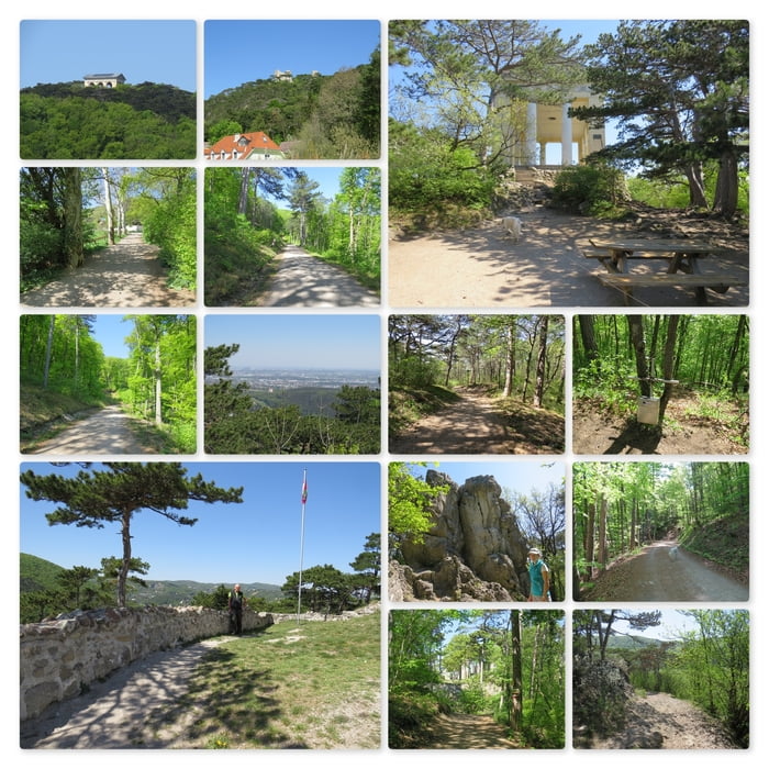

Meine Wanderung startet am Parkplatz Föhrenhof.
Nun folge ich dem breiten Wanderweg rechterhand in den Wald und finde dort den Waldspielplatz. Ich umrunde den Spielplatz beginne mit dem Aufstieg zum Husarentempel.
Hier führen viele/alle Wege nach oben; es besteht also freie Wahl. Einige Wege wurden zum Husarentempel-Trail umfunktioniert und stehen ausschließlich den Radfahrer zur Verfügung - einige Wege werden auch geteilt.
Bald erreiche ich den Husarentempel (N48 04 37.0 E16 15 06.4) und genieße die wunderbare Aussicht an diesem wunderschönen, sonnigen Fühlingstag.
Nun setzte ich meine Wanderung rechterhand zum Kleinen Anninger (N48 04 43.6 E16 14 48.8) fort. Dort bestaune ich das winzige "Gipfelkreuz" und mache nun einen großen Bogen zu meinem nächsten Ziel.
Bald erreiche ich das Matterhörndl (N48 04 18.3 E16 15 05.3). Ich bestaune den Felsen und umrunde ihn.
Die abschließende Wegstrecke führt mich außen um die Meierweiwiese herum zur Ruine Burg-Mödling (N48 04 45.7 E16 16 03.4). Nach Besichtigung der Mauern suche ich mir ein schönes Plätzchen, nehme eine kleine Jause zu mir und gönne mir ein erholsames Nickerchen in der Sonne.
Další informace v části
http://moedlingwandern.at/Trasa mapa a výškový profil
Minimální výška 254 m
Maximální výška 499 m
Více o autorovi turné
|
|
huberj59 |
Komentáře

Öffentlicher Pakrplatz Föhrenhof an den Koordinaten: N48 04 44.0 E16 15 46.0
Trasy GPS
Trackpoints-
GPX / Garmin Map Source (gpx) download
-
TCX / Garmin Training Center® (tcx) download
-
CRS / Garmin Training Center® (crs) download
-
Google Earth (kml) download
-
G7ToWin (g7t) download
-
TTQV (trk) download
-
Overlay (ovl) download
-
Fugawi (txt) download
-
Kompass (DAV) Track (tk) download
-
Formulář trasy (pdf) download
-
Původní soubor autora (gpx) download
Více o autorovi turné
|
|
huberj59 |
Přidat do oblíbených
Odebrat z oblíbených položek
Upravit značky
Open track
Moje hodnocení
Hodnotit