
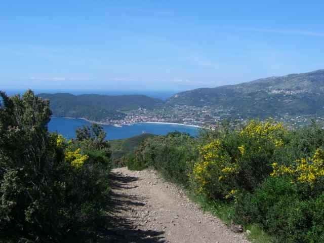

Tour from Lacona up to the Mt. Tambone and around the Mt. S. Martino down to Lacona again.
Down from Mt. Tambone to the the street (Lacona / Marina di Campo) and down to Locana are some good and difficult downhill trails (left from motor bike trail machines).
I did not ride over the Mt. S. Martino, but i marked the step into with a waypoint, if you do, send me the track to add.
There is another tour from Locana to the Mt. Tambone, going down to Mariana di Campo and Locana with variants (in up and down). The up from Locana is in this track 5minutes to hike (bad condition of way), in the other Tambone trail the up uses the street for 150m height.
Další informace v části
http://www.gps-tour.info/tours/view.php?action=view&entity=list&limitstart=0&country=Italien&federal=ToskanaGalerie tras

Trasa mapa a výškový profil
Minimální výška 12 m
Maximální výška 381 m
Více o autorovi turné
|
|
skyhopper |
Komentáře
Portoferrario, Locana, at the village end of Lacona in direction to Marina di Campo park the car (or come withe the othe Tambone tour up from Marina di Campo).
Trasy GPS
Trackpoints-
GPX / Garmin Map Source (gpx) download
-
TCX / Garmin Training Center® (tcx) download
-
CRS / Garmin Training Center® (crs) download
-
Google Earth (kml) download
-
G7ToWin (g7t) download
-
TTQV (trk) download
-
Overlay (ovl) download
-
Fugawi (txt) download
-
Kompass (DAV) Track (tk) download
-
Formulář trasy (pdf) download
-
Původní soubor autora (gpx) download
Více o autorovi turné
|
|
skyhopper |
Přidat do oblíbených
Odebrat z oblíbených položek
Upravit značky
Open track
Moje hodnocení
Hodnotit
Not suitable for biking
Gps accuracy is perfect, but leave your bike at home.
Uncycleable?
Uncycleable II