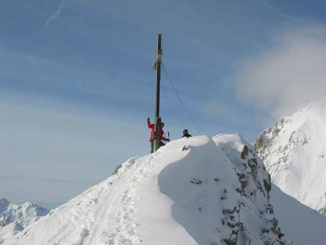
Vom Gasthof Arzkasten dem Fahrweg der zum Lehnberghaus führt bis kurz vor der ersten Brücke folgen (etwa 10 Gehminuten). Vor der Brücke nach links abbiegen und dem Bach folgen (sog. Bachweg; auch Sommerweg). Nach ca. 3 km nach rechts Richtung Lehnberghaus über eine kleine Steilstufe zum Lehnberghaus aufsteigen.
Alternativ (statt entland des Baches) über die Brücke und sofort links haltend einer schmalen Waldschneise folgen - nicht entlang des Rodelweges! Später ein kurzes Stück entlang des Rodelweges bis kurz vor dem Lehnberghaus. Nun rechts Richtung Nordosten durch eine breite ganz gerade Schneise aufwärts bis auf eine Höhe von 1.600m (bis man auf einen Fahrweg trifft). Den Fahrweg für ca. 300 m nach rechts gehen und dann links hinauf durch lichten Wald Richtung O zur sogenannten Lacke. Auf einem breiten Rücken nach Norden durch schön gestuftes Gelände aufwärts bis zum sogenannten Kanonenrohr (zwei hintereinander folgende Rinnen wobei die 2. Rinne steiler ist). Alternativ auf dem links gelegenen Rücken in einigen Spitzkehren Richtung Gipfel. Von hier immer auf dem Rücken haltend, zum Gipfelkreuz der Wankspitze.
Diese Tour ist bei vernünftiger Spurwahl kaum lawinengefährlich.
Galerie tras
Trasa mapa a výškový profil
Minimální výška
Maximální výška 2222 m
Komentáře

Von Innsbruck kommend auf der Inntalautobahn (A12) Richtung Arlberg. Ausfahrt Mötz/Fernpass Richtung Deutschland. Am Ende der Ortschaft Obsteig rechts in kleinen Fahrweg Richtung 'Gasthof Atzkasten'. Am gebührenpflichtigen Parkplatz (EUR 2,00.-) beim Gasthof Atzkasten Auto abstellen.
Trasy GPS
Trackpoints-
GPX / Garmin Map Source (gpx) download
-
TCX / Garmin Training Center® (tcx) download
-
CRS / Garmin Training Center® (crs) download
-
Google Earth (kml) download
-
G7ToWin (g7t) download
-
TTQV (trk) download
-
Overlay (ovl) download
-
Fugawi (txt) download
-
Kompass (DAV) Track (tk) download
-
Formulář trasy (pdf) download
-
Původní soubor autora (g7t) download
Přidat do oblíbených
Odebrat z oblíbených položek
Upravit značky
Open track
Moje hodnocení
Hodnotit


