Login

Passwort vergessen?

Cookies müssen akzeptiert werden!
Die Cookie-Funktion Ihres Browsers ist deaktiviert. Bitte aktivieren Sie die Funktion.

Noch kein Mitglied?

Jetzt Registrieren
Login

Nur für eingeloggte Benutzer möglich

Melde dich an, um diese Funktion nutzen zu können.

Passwort vergessen?

Cookies müssen akzeptiert werden!
Die Cookie-Funktion Ihres Browsers ist deaktiviert. Bitte aktivieren Sie die Funktion.

Noch kein Mitglied?

Jetzt Registrieren
Filter
Kategorien
Erweiterte Filter
  • Länge (km)
  • Höhenmeter
Filter speichern Filter zurücksetzen

TrackRank

QRCode

Technische Daten

Länge23,0 km Höhenmeter0 m Abstieg0 m Dauer02:00 h:m Datum30.08.2012
Bewertungen Autor Landschaft Spaßfaktor Kondition Technik

Statistik

181 Views Bewertungen 9 Downloads Durchschnitt
Bewerten
  • Tourenblatt
  • Anfahrt
  • Downloads

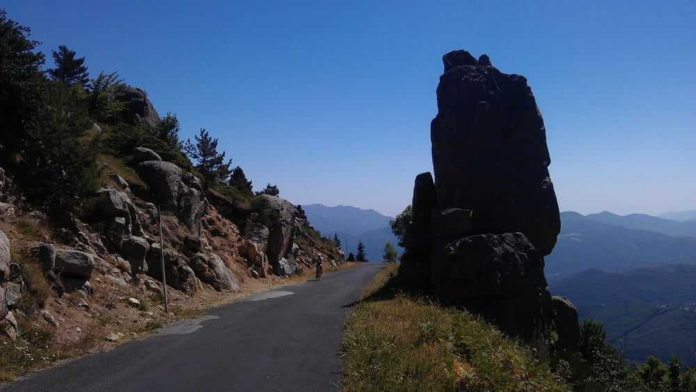
The first part of the uphill is quite steep and on sunny days you will be "kissed by the flame". The partially ruined "Église Saint-Martin de Corsavy" just before reaching the village of Corsavy is definitely worth a stop. In Corsavy refill your bottles at the fountain in the center, this will be your last chance to do so until you reach the Refuge de Batère. After Corsavy the road goes almost flat northward for some km's (nice to prepare for the final uphill).  After passing abandoned old mines and miner's homes you'll finally reach the "Refuge de Batère" (1450m) - enjoy a well earned rest up there (btw: the food is excellent).

If you want you can take a short hike on an unpaved road to the Tour the Batère (the old stone tower you've seen just before reaching the Refuge). The view from this old stone signaltower is stunning (look for other towers in sight, witch which the Tour the Batère was communicating in the past).

Tour Karte und Höhenprofil

  • Open Street Map
  • Google
Minimale Höhe 99999 m Maximale Höhe -99999 m Detailansicht

Mehr zum Tourautor

DonSegafredo
Mitglied seit 2011

Private Nachricht senden

Kommentare

Start west of Arles sur Tech, where the D43 begins. If you came by car, you'll find some place to park there.

GPS-Tracks

Trackpunkte
  • GPX / Garmin Map Source (gpx) download
  • TCX / Garmin Training Center® (tcx) download
  • CRS / Garmin Training Center® (crs) download
  • Google Earth (kml) download
  • G7ToWin (g7t) download
  • TTQV (trk) download
  • Overlay (ovl) download
  • Fugawi (txt) download
  • Kompass (DAV) Track (tk) download
  • Tourenblatt (pdf) download
  • Originaldatei des Autors (gpx) download

Mehr zum Tourautor

DonSegafredo
Mitglied seit 2011

Private Nachricht senden
Tour teilen
Zu meinen Favoriten hinzufügen
Von meinen Favoriten entfernen
Tags bearbeiten
Meine Bewertung
Bewerten
Tour: To the Refuge de Batère
Art: Rennrad
Länge: 23,0 km
Bewertet am:
Dauer:
Tag(e)
Stunde(n)
Minute(n)
Bewertung: Landschaft Spaßfaktor Kondition Technik