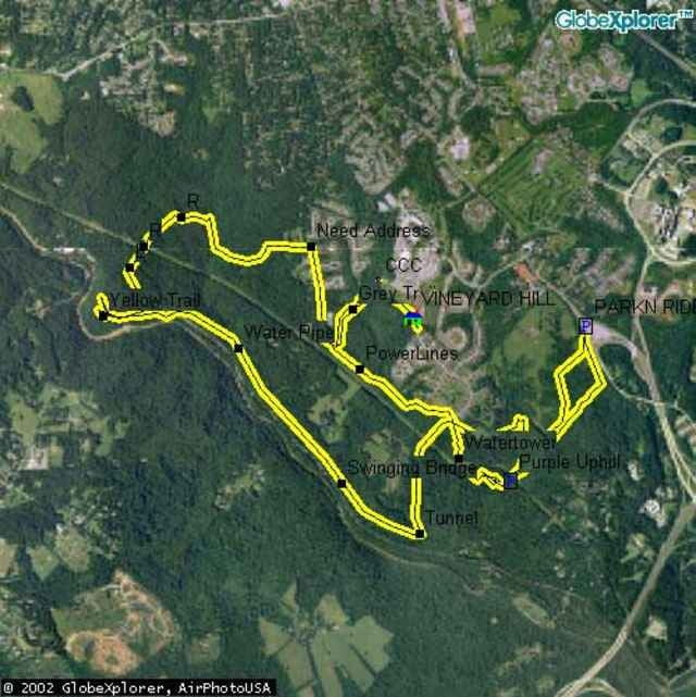
Poor drainage makes this ride horrible within 4 days of any rain, so take note. But, if there's a drought, you better make the time for this ride because it is awesome. Intermediates will enjoy the ride, and experts will love it! as long as somebody can stop M.O.R.E (a local club) from removing all the challenges of the ride. They tend to be overzealous in creating mountain biking everyone can enjoy at the expense of any advanced riders looking for a challenge.
Weitere Informationen unter
http://www.raidoh.comTour Karte und Höhenprofil
Minimale Höhe 35 m
Maximale Höhe 142 m
Kommentare
To get to the Park-N-Ride, from I95, take the Catonsville MD166 Exit and follow the signs to the PNR. Landing Road is more complicated. From I95, take MD100 East. Go North on MD Rt 1 and take a left on Montgomery Road. Right on Landing Road. Go 4 miles, trails are on the right, new houses are on the left. A street name should be posted soon.
GPS-Tracks
Trackpunkte-
GPX / Garmin Map Source (gpx) download
-
TCX / Garmin Training Center® (tcx) download
-
CRS / Garmin Training Center® (crs) download
-
Google Earth (kml) download
-
G7ToWin (g7t) download
-
TTQV (trk) download
-
Overlay (ovl) download
-
Fugawi (txt) download
-
Kompass (DAV) Track (tk) download
-
Tourenblatt (pdf) download
-
Originaldatei des Autors (g7t) download
Zu meinen Favoriten hinzufügen
Von meinen Favoriten entfernen
Tags bearbeiten
Tour öffnen
Meine Bewertung
Bewerten


Mountainbike