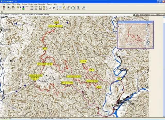
This MTB course is located near DMZ in South Korea. But, don't worry about safety. The DaeAm mountain have a swampy land at top of the mountain, named "Dragon Swamp", and this swamp is registerd The Ramsar Convention(http://www.ramsar.org) in 1997. But, you can't access the Dragon swamp, because the reason of military and preservation of wild life.
An access to the other area intorduced in this page is free. The road of this course is constructed for cultivate a forest.
An access to the other area intorduced in this page is free. The road of this course is constructed for cultivate a forest.
Tour Galerie
Tour Karte und Höhenprofil
Minimale Höhe 206 m
Maximale Höhe 1218 m
Kommentare

The trailhead is InJe-Gun, WonTong-Ry, SoJae country town.
GPS-Tracks
Trackpunkte-
GPX / Garmin Map Source (gpx) download
-
TCX / Garmin Training Center® (tcx) download
-
CRS / Garmin Training Center® (crs) download
-
Google Earth (kml) download
-
G7ToWin (g7t) download
-
TTQV (trk) download
-
Overlay (ovl) download
-
Fugawi (txt) download
-
Kompass (DAV) Track (tk) download
-
Tourenblatt (pdf) download
-
Originaldatei des Autors (gpx) download
Zu meinen Favoriten hinzufügen
Von meinen Favoriten entfernen
Tags bearbeiten
Tour öffnen
Meine Bewertung
Bewerten


