Login

Forgotten password?

Cookies have to be accepted!
Your browser's cookie functionality is disabled. Please enable this functionality.

Not a member yet?

Register now
Login

Available for registred users only

Log in to use this feature.

Forgotten password?

Cookies have to be accepted!
Your browser's cookie functionality is disabled. Please enable this functionality.

Not a member yet?

Register now
Filter
Categories
Advanced filters
  • Distance (km)
  • Height
Save filters Reset filter

TrackRank

QRCode

Technical data

Distance11,5 km Height581 m Way down432 m Duration00:00 h:m Date27.05.2012
Scores Author Landscape Fun factor Fitness Technique

Statistics

469 Views Scores 90 Downloads Average
Rate
  • Track data sheet
  • Directions
  • Downloads
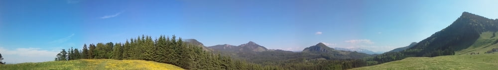
Kleine Runde auf den Heuberggipfel.

Tour gallery

Tour map and elevation profile

  • Open Street Map
  • Google
Minimum height 807 m Maximum height 1381 m Detailed view

More about the tour author

AnderasBernhardt
Member since 2011

Send private message

Comments

Verosch on 23.07.2017

Track

Lieber Andreas
Hast du den Track mal auf eine Karte gelegt und mit den Wegen verglichen? Völlig unmöglich - wie soll man das nachwandern?
LG, Rolf

Startpunkt am Duftbräu, Nähe Rosenheim.


http://www.duftbraeu.de/de/

GPS tracks

Trackpoints
  • GPX / Garmin Map Source (gpx) download
  • TCX / Garmin Training Center® (tcx) download
  • CRS / Garmin Training Center® (crs) download
  • Google Earth (kml) download
  • G7ToWin (g7t) download
  • TTQV (trk) download
  • Overlay (ovl) download
  • Fugawi (txt) download
  • Kompass (DAV) Track (tk) download
  • Track data sheet (pdf) download
  • Original file of the author (gpx) download

More about the tour author

AnderasBernhardt
Member since 2011

Send private message
Share track
Add to my favorites
Remove from my favorites
Edit tags
My score
Rate
Track: Rauf auf den Heuberg ...
Type: Hiking
Distance: 11,5 km
Evaluated on:
Duration:
Day(s)
Hour(s)
Minute(s)
Score: Landscape Fun factor Fitness Technique