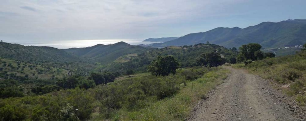
Recorrido en bicicleta de montaña con alforjas que cruza los Pirineos de esta a oeste, por su vertiente sur, desde el Mediterráneo (Llança como punto de partida) hasta al Atlántico (y Hondarribia como punto final). Toma como referencia la guía "La travesía de los Pirineos en BTT", de Jordi Laparra y editada por Prames, siguiendo su itinerario principal excepto para tomar la variante de Ordesa-Sierra de Cutas.
Fecha: 25 de Junio al 11 de Julio de 2012.
Track: Wikiloc (completo) y Cicloide (etapas).
Fotos: Picasa (Transpirenaica en BTT).
Etapas.
01. Llança-Albanya. Por el Alt Empordà, desde el Mediterráneo a la Alta Garrotxa.
Dist.: 67,64 Km.; Asc.: 1.637 m.; T. Mov.: 5:47; IBP.: 111AB.
Alojamiento: Camping Bassegoda Park.
02. Albanya-Camprodón. Por la Alta Garrotxa, del Alt Empordà al Ripolles.
Dist.: 57,24 Km.; Asc.: 1.759 m.; T. Mov.: 5:35; IBP.: 132AB.
Alojamiento: Camping Valle de Camprodón.
03. Camprodón-Planoles. Por el Ripollès, del Valle del Ter al Valle del Rigard.
Dist.: 62,76 Km.; Asc.: 1.849 m.; T. Mov.. 5:38; IBP.: 119BB.
Alojamiento: Albergue Juvenil Pere Figuera.
04. Planoles-Bagà. Del Ripollès al Berguedà, por La Molina y Masella.
Dist.: 57,43 Km.; Asc.: 1.698 m.; T. Mov.: 5:21; IBP.: 128AB.
Alojamiento: Camping Bastareny.
Dist.: 68,00 Km.; Asc.: 1.671 m.; T. Mov.: 6:21; IBP.: 120AB.
Alojamiento: Hostal Llorer.
Dist.: 58,57 Km.; Asc.: 1.314 m.; T. Mov.: 5:04; IBP.: 101AB.
Alojamiento: Camping Riberies.
Dist.: 61,45 Km.; Asc.: 1.670 m.; T. Mov.: 6:07; IBP.: 107BB.
Alojamiento: Albergue La Torre.
Dist.: 50,06 Km.; Asc.: 1.410 m.; T. Mov.; 4:35; IBP.: 107AA.
Alojamiento: Camping Can Roig.
14. Aragües del Puerto-Isaba. Por los Valles Occidentales del Pirineo, de los Valles de Ansó y Hecho en Aragón al Valle del Roncal en Navarra.
Dist.: 52,99 Km.; Asc.: 1.336 m.; T. Mov.: 4:57; IBP.: 109AA.
Alojamiento: Albergue Oxanea.
15. Isaba-Roncesvalles. Por la Selva de Irati, del Valle de Roncal a Roncesvalles.
Dist.: 73,40 Km.; Asc.: 1.468 m.; T. Mov.: 5:51; IBP.: 105AB.
Alojamiento: Albergue de Peregrinos Colegiata de Roncesvalles.
16. Roncesvalles-Etxalar. Por el Valle del Baztán, de Roncesvalles al Valle del Bidasoa.
Dist.: 68,96 Km.; Asc.: 1.610 m.; T. Mov.: 5:33; IBP.: 154AB.
Alojamiento: Albergue Tompalenea
17. Etxalar-Hondarribia-Irún. Por el Valle del Bidasoa hasta la Costa Cantábrica.
Dist.: 49,53 Km.; Asc.: 1.031 m.; T. Mov.: 4:28; IBP.: 112AA.
Alojamiento: Albergue Juvenil Martindozenea.
Más información: zinaztli.blogspot.com.es/2012/07/transpirenaica-en-btt-ficha-del-viaje.html
Tour map and elevation profile
Comments

GPS tracks
Trackpoints-
GPX / Garmin Map Source (gpx) download
-
TCX / Garmin Training Center® (tcx) download
-
CRS / Garmin Training Center® (crs) download
-
Google Earth (kml) download
-
G7ToWin (g7t) download
-
TTQV (trk) download
-
Overlay (ovl) download
-
Fugawi (txt) download
-
Kompass (DAV) Track (tk) download
-
Track data sheet (pdf) download
-
Original file of the author (gpx) download

