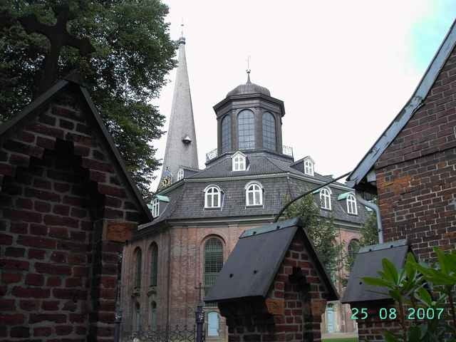
Vorbei an der Wasserskianlage Pinneberg, Rellinger Barockkirche, durch einen Teil des größten, zusammenhängenden Baumschulgebietes der Welt, Kollauwanderweg, Niendorfer Gehege mit Tierpark, Flughafen Hamburg, Flußlandschaft Tarpenbek zur Außenalster, Pöseldorf, Milchstraße, Rotherbaum, Lutherpark und -Kirche, Bahrenfelder See, Volkspark Altona mit Schulgarten, Pavillon, Teichanlage und Dahliengarten, Osdorfer Born Park, Friedrichshulde mit Waldquelle, Baumschulmuseum Thesdorf.
Das letzte Stück bis kurz vor dem Ziel zum S-Bahnhof Thesdorf geht es ca. 200m parallel zur S-Bahn auf schmalem Trampelpfad (ungeeignet für Fahrradanhänger).
Das letzte Stück bis kurz vor dem Ziel zum S-Bahnhof Thesdorf geht es ca. 200m parallel zur S-Bahn auf schmalem Trampelpfad (ungeeignet für Fahrradanhänger).
Further information at
http://www.mrk-rellingen.deTour map and elevation profile
Minimum height -4 m
Maximum height 49 m
Comments

Die Tour startet am S-Bahnhof Thesdorf (S3 / S21) ca. 20 Min. per S-Bahn aus der Hamburger Innenstadt Richtung Pinneberg oder mit dem PKW über die A 23 Abfahrt Thesdorf zum P+R Parkplatz S-Bahnhof Thesdorf.
GPS tracks
Trackpoints-
GPX / Garmin Map Source (gpx) download
-
TCX / Garmin Training Center® (tcx) download
-
CRS / Garmin Training Center® (crs) download
-
Google Earth (kml) download
-
G7ToWin (g7t) download
-
TTQV (trk) download
-
Overlay (ovl) download
-
Fugawi (txt) download
-
Kompass (DAV) Track (tk) download
-
Track data sheet (pdf) download
-
Original file of the author (gpx) download
Add to my favorites
Remove from my favorites
Edit tags
Open track
My score
Rate


