Login

Forgotten password?

Cookies have to be accepted!
Your browser's cookie functionality is disabled. Please enable this functionality.

Not a member yet?

Register now
Login

Available for registred users only

Log in to use this feature.

Forgotten password?

Cookies have to be accepted!
Your browser's cookie functionality is disabled. Please enable this functionality.

Not a member yet?

Register now
Filter
Categories
Advanced filters
  • Distance (km)
  • Height
Save filters Reset filter

TrackRank

QRCode

Technical data

Distance11,1 km Height1161 m Way down1161 m Duration00:00 h:m Date11.10.2012
Scores Author Landscape Fun factor Fitness Technique

Statistics

278 Views Scores 21 Downloads Average
Rate
  • Track data sheet
  • Directions
  • Downloads

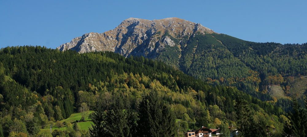
Die anspruchsvolle 11,1km lange Bergtour auf den Großen Pyhrgas 2.244m ist sehr abwechslungsreich und landschaftlich besonders schön. Am Gipfel des höchsten Berges in den Haller Mauern erwartet dich eine wunderbare Aussicht in alle Himmelsrichtungen. Dabei besonders interessant sind im Norden das Sengsengebirge im Nationalpark Kalkalpen, im Osten und Süden das Gesäuse mit dem benachbarten Bergen Kleiner Pyhrgas, Scheiblingstein und Bosruck. Nach Westen hin siehst du bis zum Dachstein, Grimming, Warscheneck, Spitzmauer und Großer Priel. Für die 1161 Höhenmeter solltest du neben einer guten Kondition auch eine hohe Trittsicherheit mitbringen. Diese Bergtour ist nur bei trockenen Wanderwegen empfehlenswert.

weitere Infos und Fotos auf biketours4you.at

Tour gallery

Tour map and elevation profile

  • Open Street Map
  • Google
Minimum height 1021 m Maximum height 2216 m Detailed view

More about the tour author

Trek1400d
Member since 2008

Send private message

Comments

GPS tracks

Trackpoints
  • GPX / Garmin Map Source (gpx) download
  • TCX / Garmin Training Center® (tcx) download
  • CRS / Garmin Training Center® (crs) download
  • Google Earth (kml) download
  • G7ToWin (g7t) download
  • TTQV (trk) download
  • Overlay (ovl) download
  • Fugawi (txt) download
  • Kompass (DAV) Track (tk) download
  • Track data sheet (pdf) download
  • Original file of the author (gpx) download

More about the tour author

Trek1400d
Member since 2008

Send private message
Share track
Add to my favorites
Remove from my favorites
Edit tags
My score
Rate
Track: Großer Pyhrgas
Type: Mountain hiking
Distance: 11,1 km
Evaluated on:
Duration:
Day(s)
Hour(s)
Minute(s)
Score: Landscape Fun factor Fitness Technique