


Große Mühltal Runde
Start in Rohrbach - geht den Vierlingerberg hinauf und weiter Richtung Kolonödt gen Aigen -
kurz nach Gasthof Kolonödt rechts entlang des "Schlägler Rundweges"
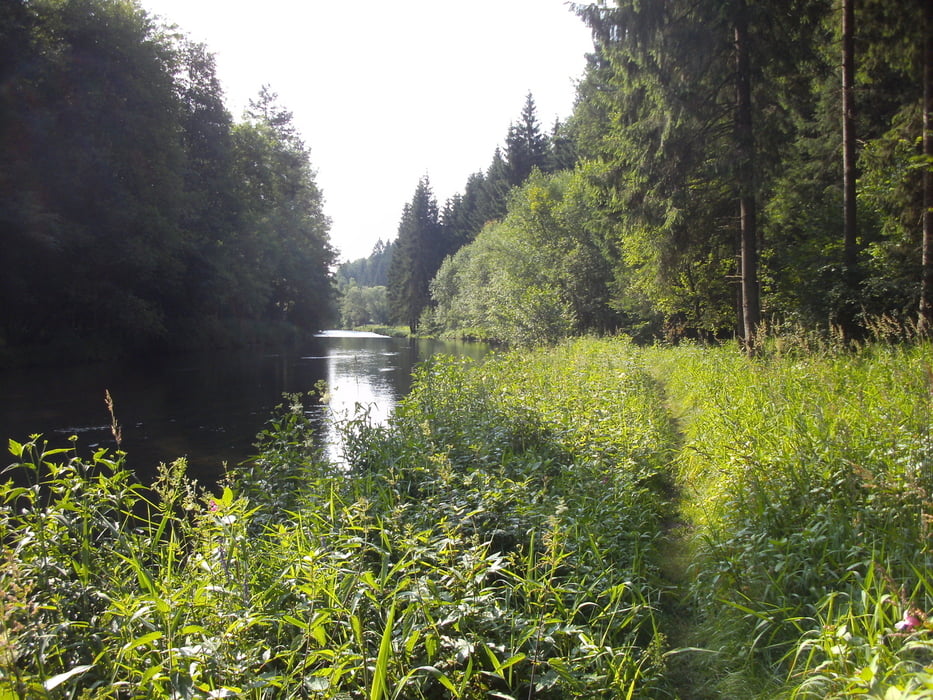
vorbei bei einem Steinbruch zur Grossen MÜHL - Flußüberqerung und ab geht's in den Wald hinein!
W1 Wanderweg Große Mühl - Stationen: - Furtmühle - Kranzling bei Haslach - Teufelmühle - Stausee Neufelden - Mühltalthof - und letztendlich Untermühl !
Achtung!!! Radfahr,- und Reitverbot zwischen Furtmühle und Badeplatz Haslach Kranzling !!!
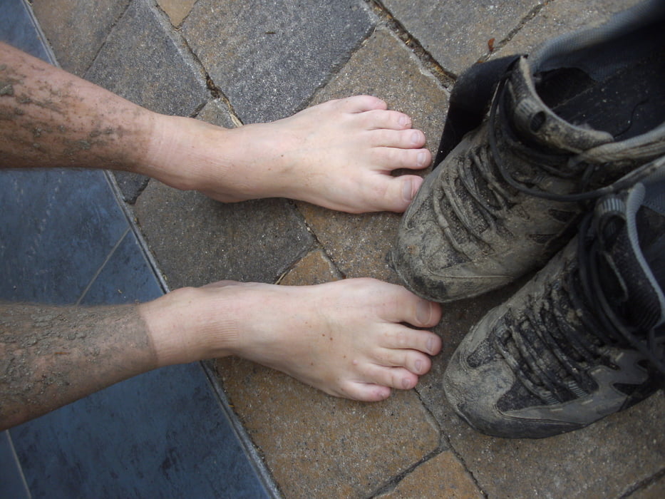
Der Weg ist ganzjährlich sehr saftig zu fahren - sprich keine helle Kleidung tragen! Von Untermühl geht's entlang der Donau nach Obermühl - super Gasthof zum Stärken für die letzten 18km retour nach Rohrbach auf Asphalt!
Alternativ - Anreise mit der Mühlkreisbahn von Linz nach Aigen - Tour wie beschrieben zur Donau - verwenden einer Fähre in Untermühl oder Obermühl und Weiterfahrt auf Radweg nach Linz!
Tour gallery


Tour map and elevation profile
Minimum height 278 m
Maximum height 684 m
More about the tour author
|
|
Hoar |
Comments

Abfahrt und Ankunft in 4150 Rohrbach in OÖ
oder an der Strecke - Rundkurs
GPS tracks
Trackpoints-
GPX / Garmin Map Source (gpx) download
-
TCX / Garmin Training Center® (tcx) download
-
CRS / Garmin Training Center® (crs) download
-
Google Earth (kml) download
-
G7ToWin (g7t) download
-
TTQV (trk) download
-
Overlay (ovl) download
-
Fugawi (txt) download
-
Kompass (DAV) Track (tk) download
-
Track data sheet (pdf) download
-
Original file of the author (gpx) download
More about the tour author
|
|
Hoar |
Add to my favorites
Remove from my favorites
Edit tags
Open track
My score
Rate